Desire Lines
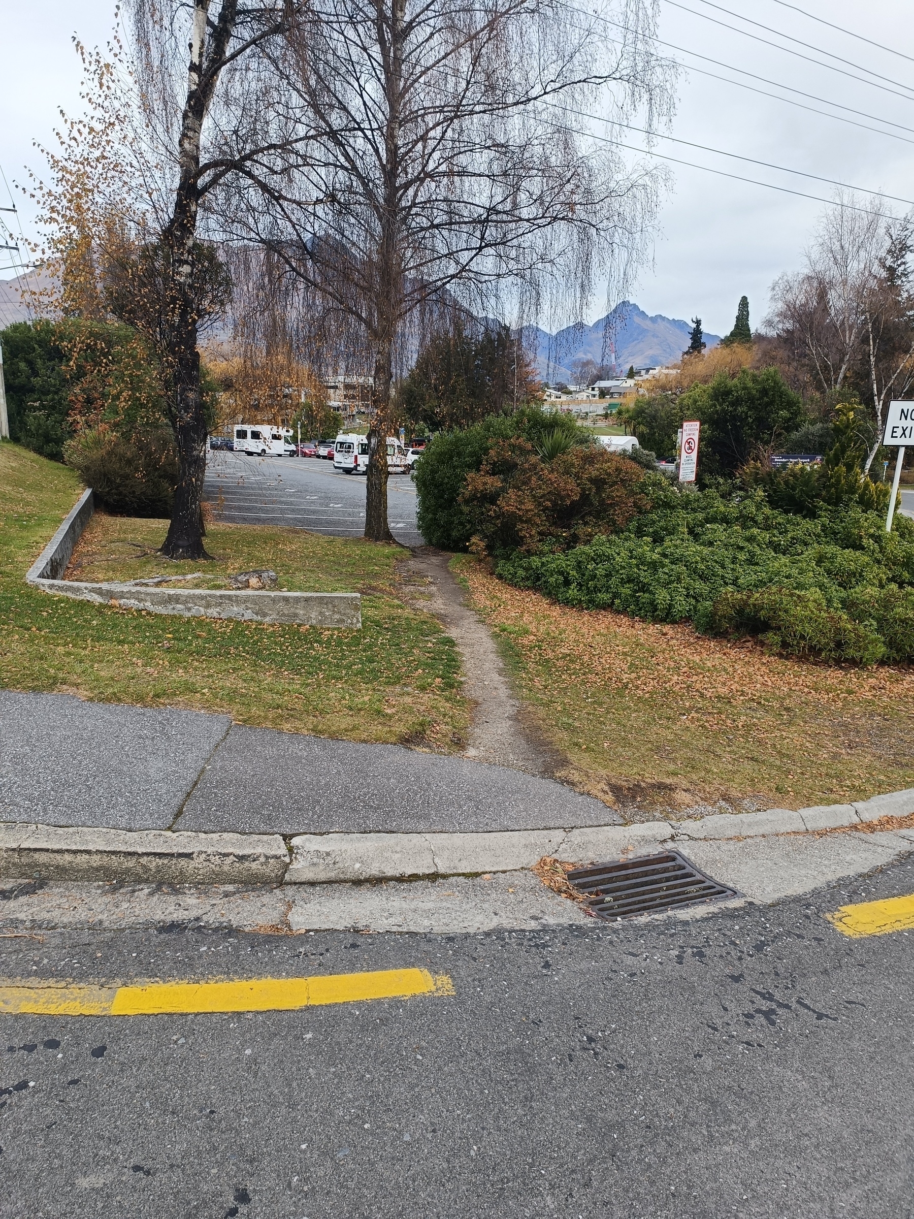
Desire line swinging under a birch tree into the public carpark. There’s a vehicle entrance to the right of the shrub for wet days. The carpark takes 33 campervans and it’s regularly full in peak periods. I occasionally trot this path on my lunch walks.
#DesireLine #DesirePath #Psychogeography
Morning shadows
This 200m stretch runs through private land but the owner let’s people through. Usually gates are open but sometimes there’s sheep inside so we have to close gates behind us. It’s a regular for commuters into town cutting off a small distance and hill.
This morning I rode this way to spend the day with my sister’s fam. I went for a jog while they got ready then we hiked the Mt Crichton loop track followed by a pub feed. Lights were on for the ride home. Everyone’s truely knackered.

#DesireLine #DesirePath #psychogeography
Snapped a few desire lines around town.
First one connects the rec ground from the one way access road that connects to the public carpark and library. I sometimes use this on work days to have lunch at the park. Conveniently formed into steps.
 Photos 2 and 3 show a line that skirts the bank around the park, and someone perched under a willow for lunch.

 This one connects the footpath up at the main road to the public carpark at a lower level. There’s a bitumen ramped path not far to the right but this one is clearly popular.
 Another popular line with a main bus hub around the corner. A nice garden on the right under the sign would spruce this up.

#DesireLine #desirePath #psychogeography
This wee track goes to a nice swimming or fishing spot along the Kawarau River. It is a sheltered nook with a shallow bank, but don’t go too far or you’ll get swept away. Popular with the locals.


#DesireLine #desirePath #psychogeography
Weighing up how I build the desire lines data schema and what makes the cut.
First one has become quite a heavily used locals track that skirts closer to the river than the main Twin Rivers Trail, giving access to the riverbank on occasion. It is walled by Buddleia for a good part of it which is beaut in flower and provides shade, however it is a pest plant.
The path is mapped in OpenStreetMap as a footway (red dash) and visible from the aerial imagery, however it is not captured in the Google Earth data or the local Council’s data (solid yellow).


 This second one saves the day when there’s been a bit of rain.

 I think I’ll keep both these in and just build the schema around what’s going on.
#DesireLine #DesirePath #psychogeography #walking #GIS
Brave souls take the right to join the mayhem of our busiest roundabout, and more direct route into town. Left is the formed path to the bus hub and (relative) safety of pedestrian islands.
 This one now almost looking like a formed path, cuts straight across the Events Centre entrance. Cyclist about to hit it. Given its not formed you have to contend with a gutter, protruding pipe, stump of a hedge plant and puddles in the wet.
 Other side. A couple years back I had to squeeze between those hedges.
 Cones are for tree removals which is the kick off of the 4 year transport project affecting all the areas in the above photos, and likely the desire lines will be retired. Will new ones form, or will the new design funnel us onto the intended routes? 🤔
#DesireLine #DesirePath #psychogeography #walking
Desire lines and psychogeography
Stumbled across the term “psychogeography” which Wikipedia describes as “the exploration of urban environments that emphasizes interpersonal connections to places and arbitrary routes.”
I’ve come to realise that I put a lot (maybe too much?) of thought into the routes I choose, be it for commuting, getting across town, or a lunchtime walk. Deciding the route can be driven by.. efficiency, spatial distribution of the destinations, what I need to drop off or pick up, mode of transport (which is again driven by a bunch of decisions)… yada yada..
Outside the urban environment, I plan my routes to another level when running in the mountains, often driven by risk vs reward, and often changing on the fly as difficult or enticing landscapes unfold, weather rolls in, or fatigue or energy kicks in.
I’ve decided to start a wee project and explore the urban side of psychogeography by capturing “desire lines” as I stumble across them. Desire lines are an interesting topic in itself which I feel aligns well to the concept of psychogeography. As part of the project I’ll take photos of the line and explore the reasoning behind them. I might eventually include some maps to get the wider picture.
I’ll kick off with today’s short 3km loop to the corner store.
This desire line sits on a street corner and descends from a bike pump track and playground. The bikes have rutted out the top and made it an obvious line of attack. At the top I walked across the pump track and the adjoining sports field to connect to a formed track.
 A very common desire line cutting a corner. I doubt any bike rider would take the hard corner. Potentially walkers would on a wet day.
 Two tiers here. Mountain biking is a big thing here and kids create these everywhere. I love seeing the kids wielding shovels and egging each other on to do the jumps. There is a wee jump at the top of the green patch here.
 This is the top section. Convenient connector as the Council-maintained formed path adds some unnecessary distance. Looks fun for the kids too, especially when they hit the jump just to the right off screen.
 Standard corner footpath desire line at a roundabout. Much quicker for the able-bodied and traffic-aware. Again bikes are forming this up well.

#DesireLine #DesirePath #psychogeography