Trail Running
- On the western side up from the Matakauri Wetland, weaving through climbers anchors and ropes, is the steepest entrance. Once through the climbing bits you’re onto a network of MTB trails. Plenty of fun to be had here.
- Tucked between a couple of buildings a couple hundred meters up Gorge Rd is another entrance which gets you straight onto the MTB trails, bypassing the climbing bits.
- On the southern side off Vancouver Drive is a fire trail which gets you under the powerlines and more MTB trails or the main track beyond.
- On the eastern side tucked behind the reserve off Highview Terrace is another entrance that leads straight into more MTB trails.
- Trot to the top
- 3x reps, progressing efforts each rep
- Fartlek
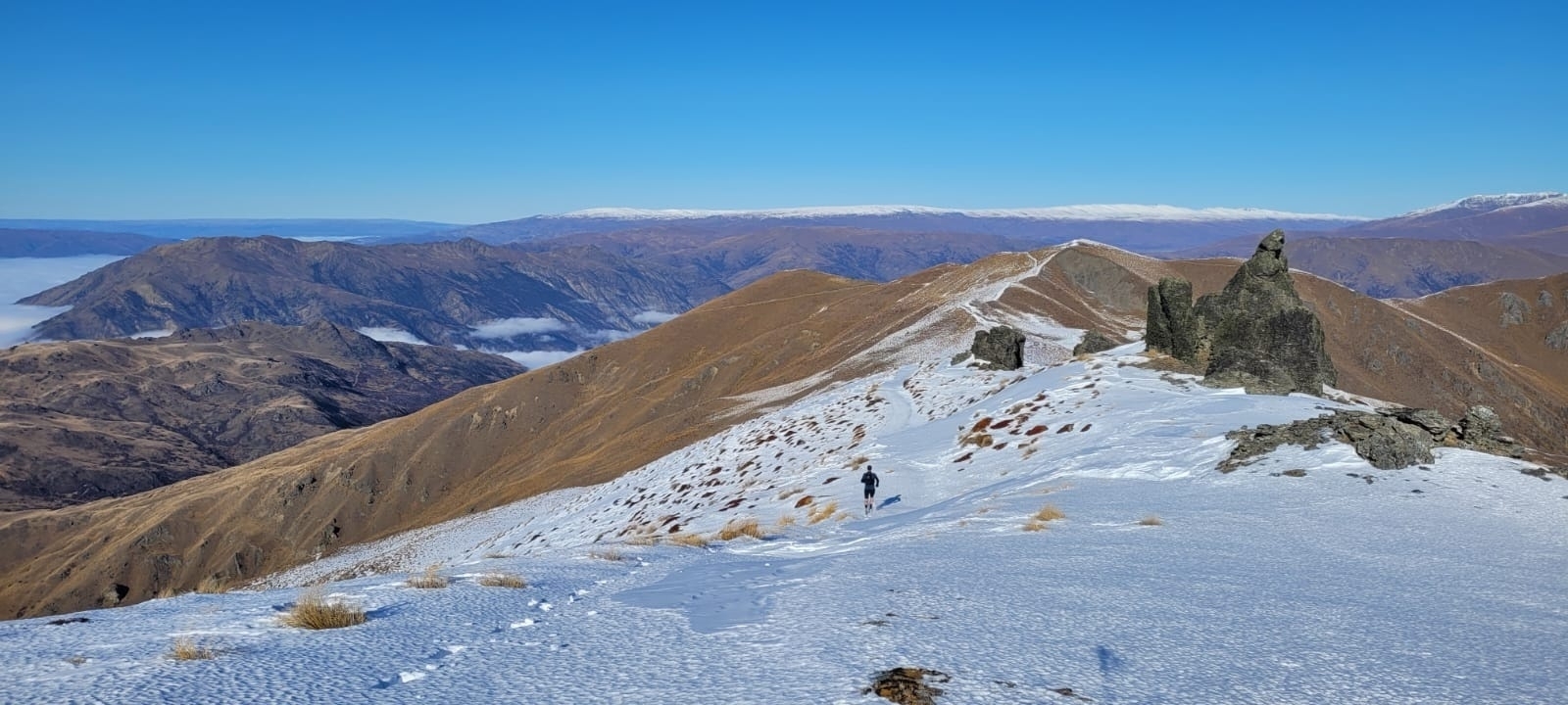
- Scramble the ridge to the end and loop back onto Bush Creek Trail (tip: duck into southern side of Coronet Forest for the first few hundred metres to avoid the dead wildings which are impenetrable (trust me) - there was some blue marker tape last time I did this)
- Add Feehly Hill for another little climb and flat rest between hills.
- Add anything on the other side of Bush Creek.
- Include it in a ridiculous vert challenge.
- Distance: 79.96km
- Elevation: 10,099m
- Elapsed Time: 23:38:43
- Trot the easier gradients, hike the rest.
- Regular fueling, mix of gels, bars, powdered electrolytes, lollies, pizza and noodles for the cold parts of the night.
- Use poles.
- Just a waist pack on the smaller hill.
- When I want to pull the pin, accept that is a pretty normal feeling, and keep going.
- Distance: 69.25km
- Elevation: 4,394m
- Moving Time: 13:42:31 (I was moving much longer, but I was so slow my watch didn’t notice)
- Elapsed Time: 20:59:14
Snow run out the back of Arrowtown (Miner’s trail). Also, I’m sick. Probably shouldn’t have done that, but I needed to check, and yep, definitely sick. 2024 has been shyte. #trailrunning
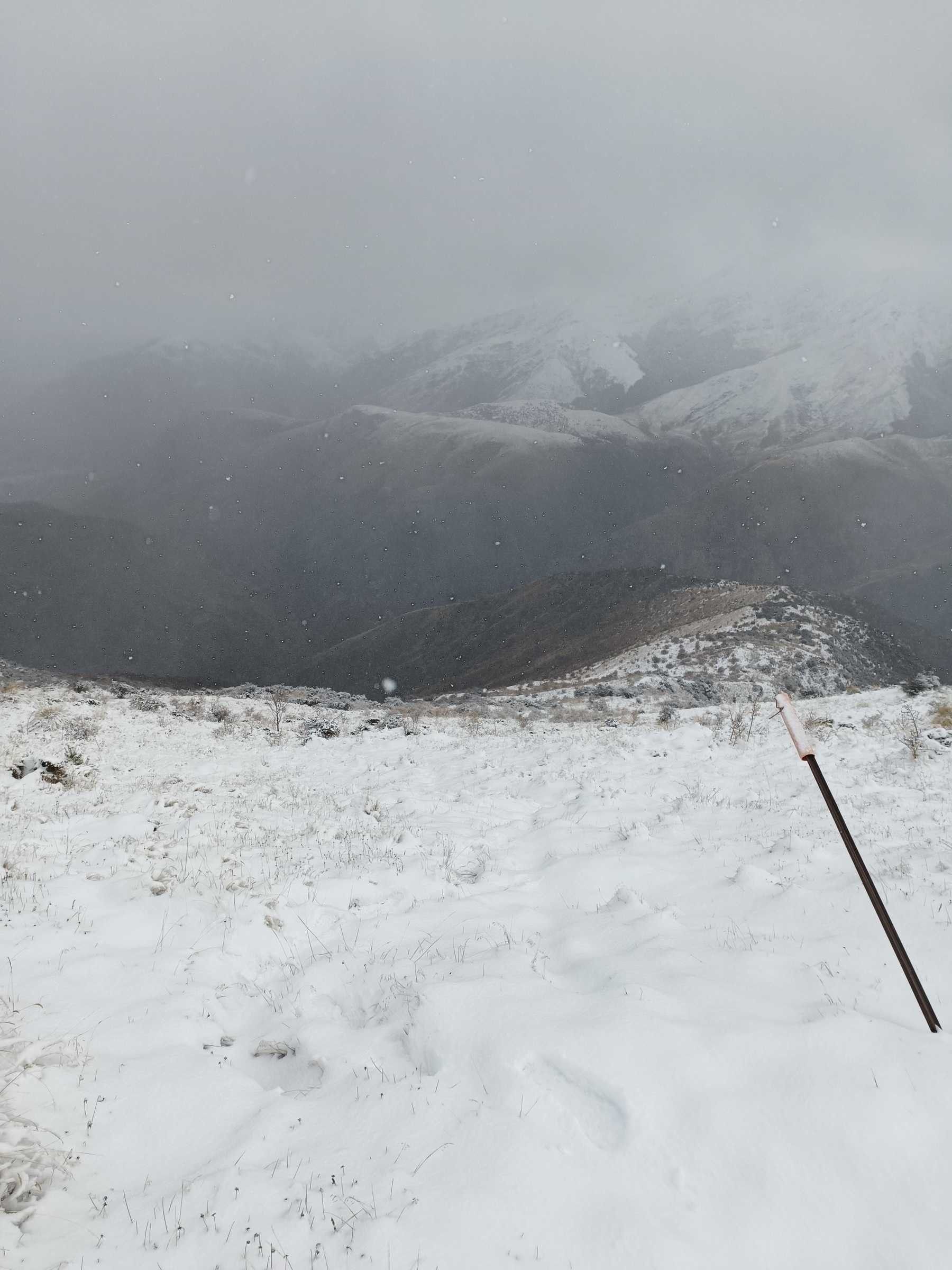
Hard slog but very rewarding run today with beaut weather and good chats. First 3k in the fog, next 7km under the snowline, then 20k of undulating snow covered range “running” making it slow and taxing. Point to point. 29.97km/2049m. First longrun in a while. I’m wrecked!
#trailrunning
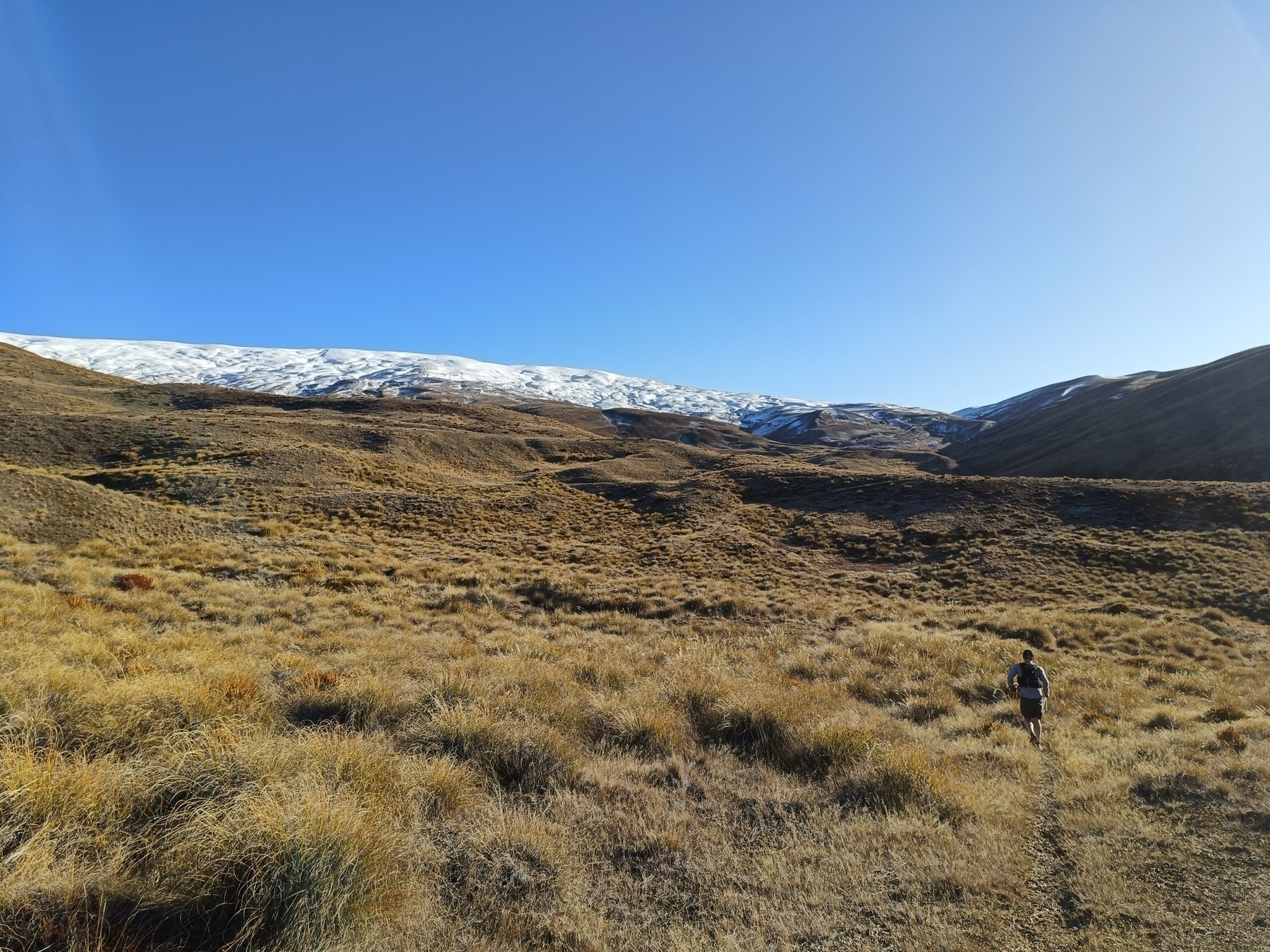
It’s hard to get out the door for a run at -2°C but scheduling with a mate increases the chance of it happening. Gonna be a cold one. Cool route planned today. First long-run in a while.
Current #queenstown #trailrunning conditions. 👌 Fernhill loop
Glorious day to be back at it. Knees felt good. In fact, I could feel the new muscle groups (from strengthening exercises) doing their thing. Maybe I’ll bounce back stronger.. 🤔 #trailrunning
Training ground - Queenstown Hill
Queenstown Hill is a nice little 500m climb tucked just behind town. It has a Council-maintained trail to the “Basket of Dreams” and is one of the more popular walks given the proximity to town and carpark at the base of the main trailhead off Belfast Terrace (south-west face of hill). There are a myriad of guerilla mountain bike trails scattered within which makes for fun alternative routes.
The actual peak is on private land and sign-posted to stay clear.
There are 4 alternative entrances that I know of:
I used to live right under here on the south-east side at the lakefront so it was a regular. I’ve since moved 15k away but I still work in town so usually pop out the office door in the evenings before heading home.
My favourite bits are the rock-climbers route on the western side and the MTB trails on the eastern side.
All my GPX files that touch the hill, including some jaunts that stitched on some other hills to the west.
If you zoom right in you can see those fat lines are made up of a tonne of outings. My python coding picked up 143 jaunts to date.A bunch of my GPX files overlayed, just coz.
 Chart shows where I’ve done some up+down-to-the-top sessions, a couple of doubles, a longer one starting on the flats, and the little flat bits around 450m that are the stretches of road when I’ve entered/exited from the east.
Views. Bit moody this day.
 Basket of Dreams with Ben Lomond (left) and Bowen Peak (right) beyond.
 Afternoon sun casting a silhouette of mountains on the Remarkables.
 Having fun in the mud. I spent 6 hours on the hill this day covering 35km and 3,128m.
 MTB trails.
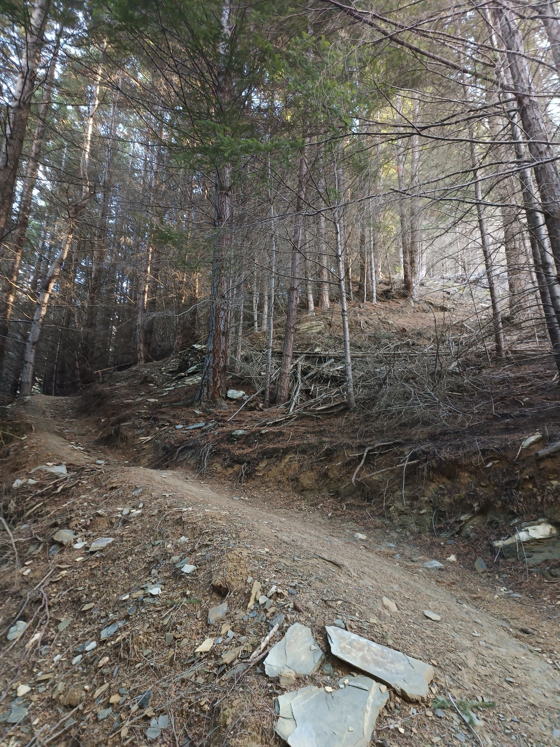
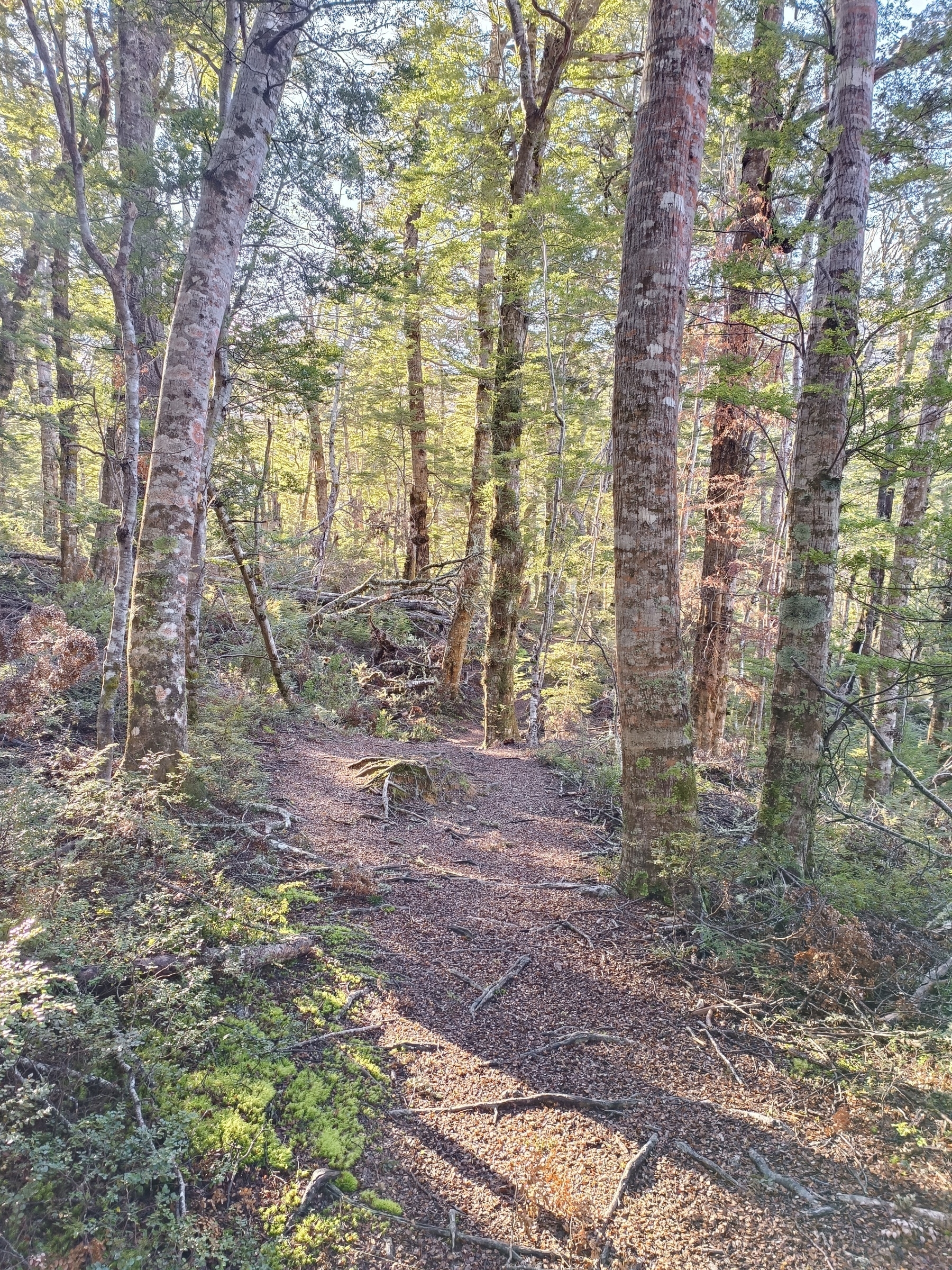
 Lots of pine.
 Wintery night trots.
 Many locks on the gate off Vancouver Drive.

 A million cairns in case you get lost.


#trailrunning #trainingground
Mountain biking is huge here. With it comes a network of guerilla downhill tracks scattered in our hills, often hidden just off the sides of maintained trails. For me they’re some of my favourite trails to run up and down.
#trailrunning #Queenstown
Training hill - back o' CF
 An unmaintained track at the back of Coronet Forest recreational reserve, part guerilla downhill MTB trail, part desire lines created by local recreational users and trappers. Becomes greasy in the colder months with the silty soil. Canters and narrow sections between Matagouri (NZ native) and broom (pest plant) keeps me on my toes (or off), well scratched up and muddy.
With an average 24% gradient, its up there for steepness.
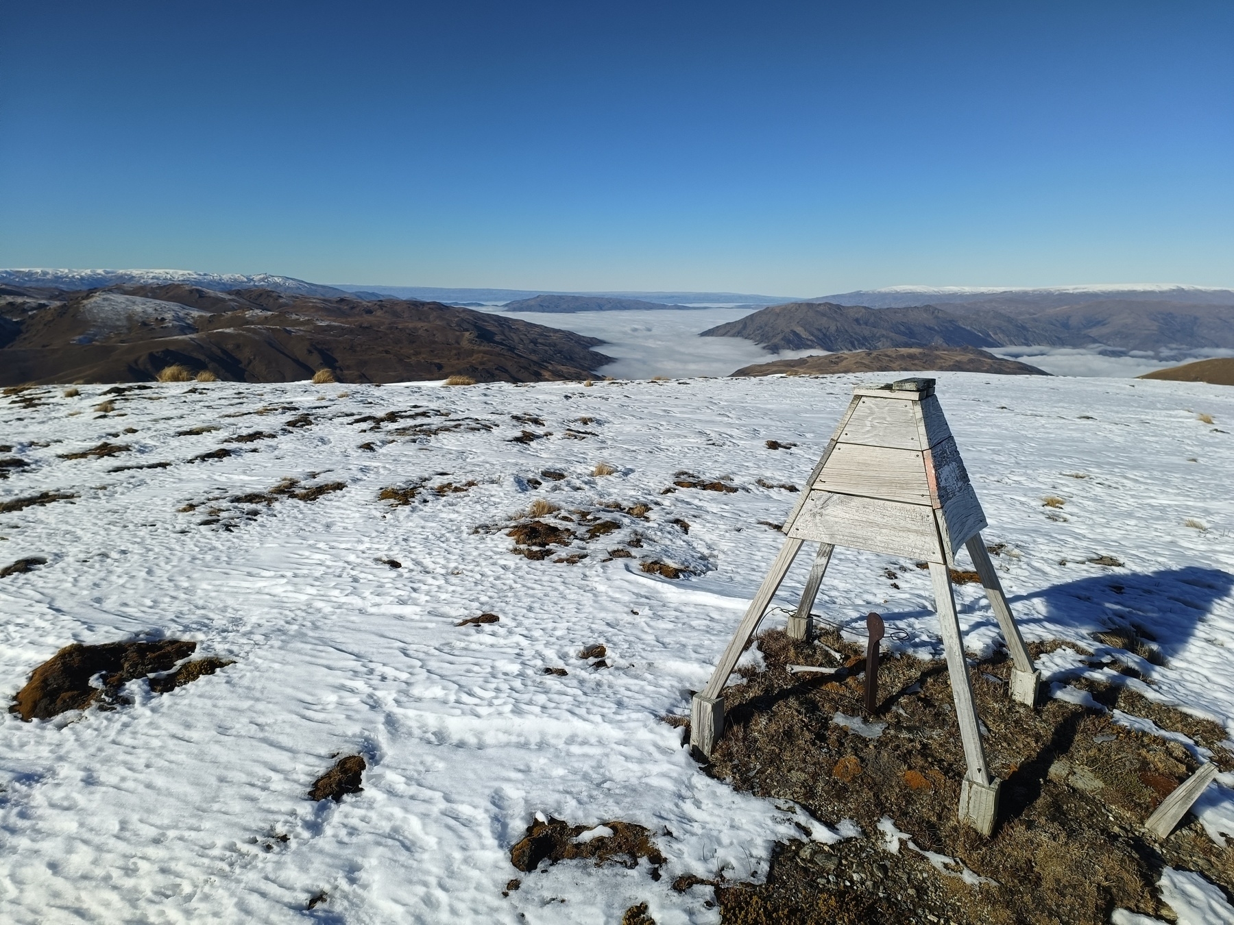
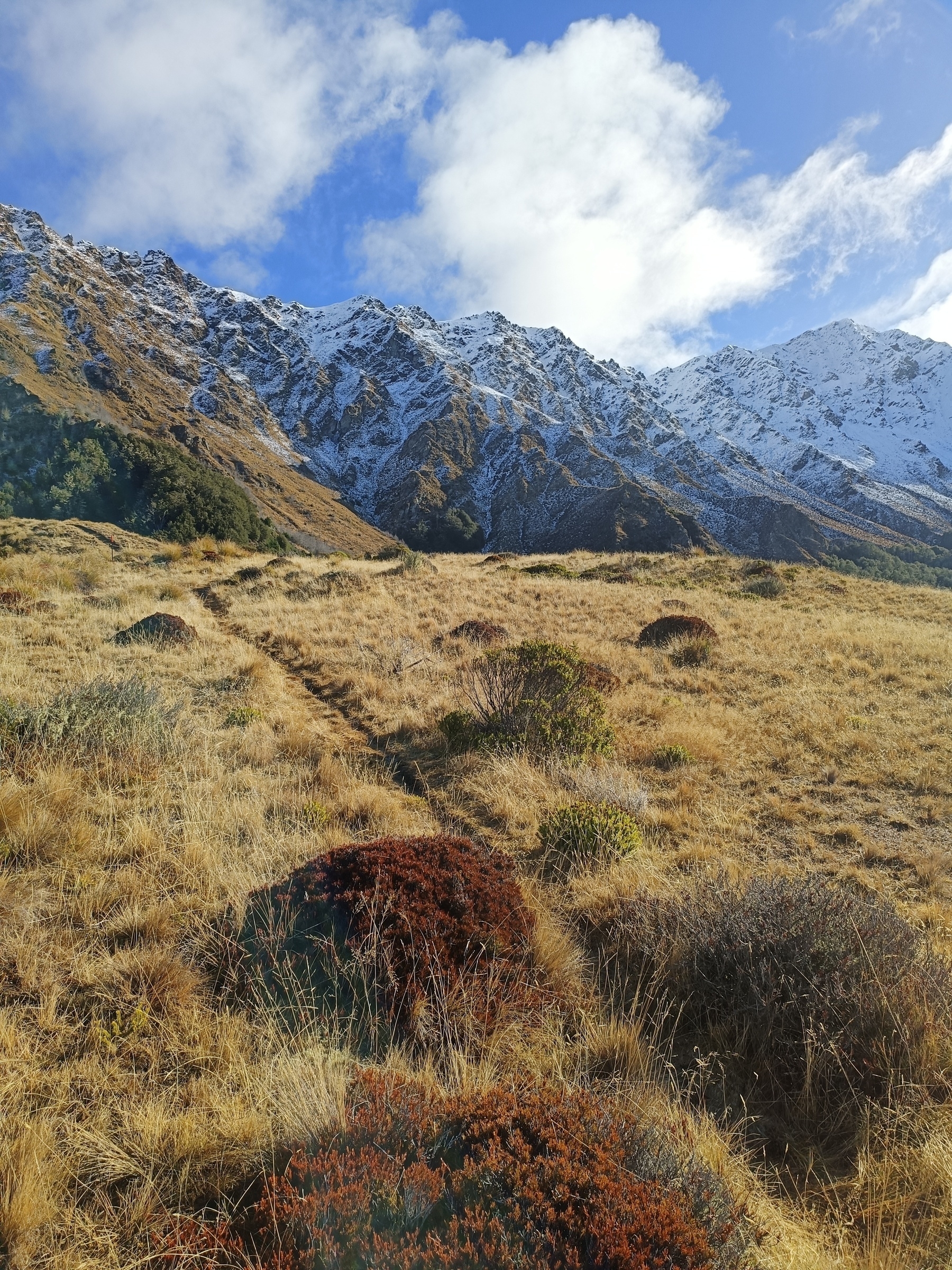
There’s a trig station at the top (A3KE) and great views of Arrowtown to Queenstown with Remarkables in the backdrop. In the other direction Coronet and Brow Peaks.
From the trig beyond, on the southern face, Coronet Forest has just had all the wilding pines removed as part of a long term revegetation project so it is looking very bare at the moment. Revegetation is on its way with recreational improvements not long after. I’m sure that will eventually have an affect on this little backside of the reserve.
It can be fun in the rain often ending with a muddy arse. Because of the canters, narrow and often greasy terrain this is a great one to put stability, ankles and knees to the test. I find gloves handy as I brush through the prickly stuff, or grab onto a tree or branch if I’ve completely fallen off the track (…it happens).
I’ve seen less than 10 people in ~100 visits so its relatively quiet, which is great for those hard sessions where I become a heaving, snotty, muddy and sometimes bloody mess.
Some of my favourite sessions here:
Some variations:


 A3KE:
A3KE:
 Views of Arrowtown and Feehly Hill down below:
 Wilding removals looking west on the southern face of Coronet (no-longer) Forest:
 Views of Brow Peak looking north:

#trailrunning #trainingground
10,000m in 24 hours
For my birthday back in 2022 I treated myself to a wee challenge - Go up and down some hills for 24 hours and snag 10,000m of vert. Similar to Everesting where the target is 8,848m, though I couldn’t claim an Everest because I used two peaks. I’m usually pretty tuned in to my limits, and I was fairly certain I could bag this one if I didn’t injure myself. I had never done more than 5,000m in one outing though so I was still stepping into unknown territory, as I like to do with DIY adventures.
The Route
I chose this spot out the back of Arrowtown (20 minutes from home) because I could park my car pretty much at the base of the two climbs and use the boot as an aid station.

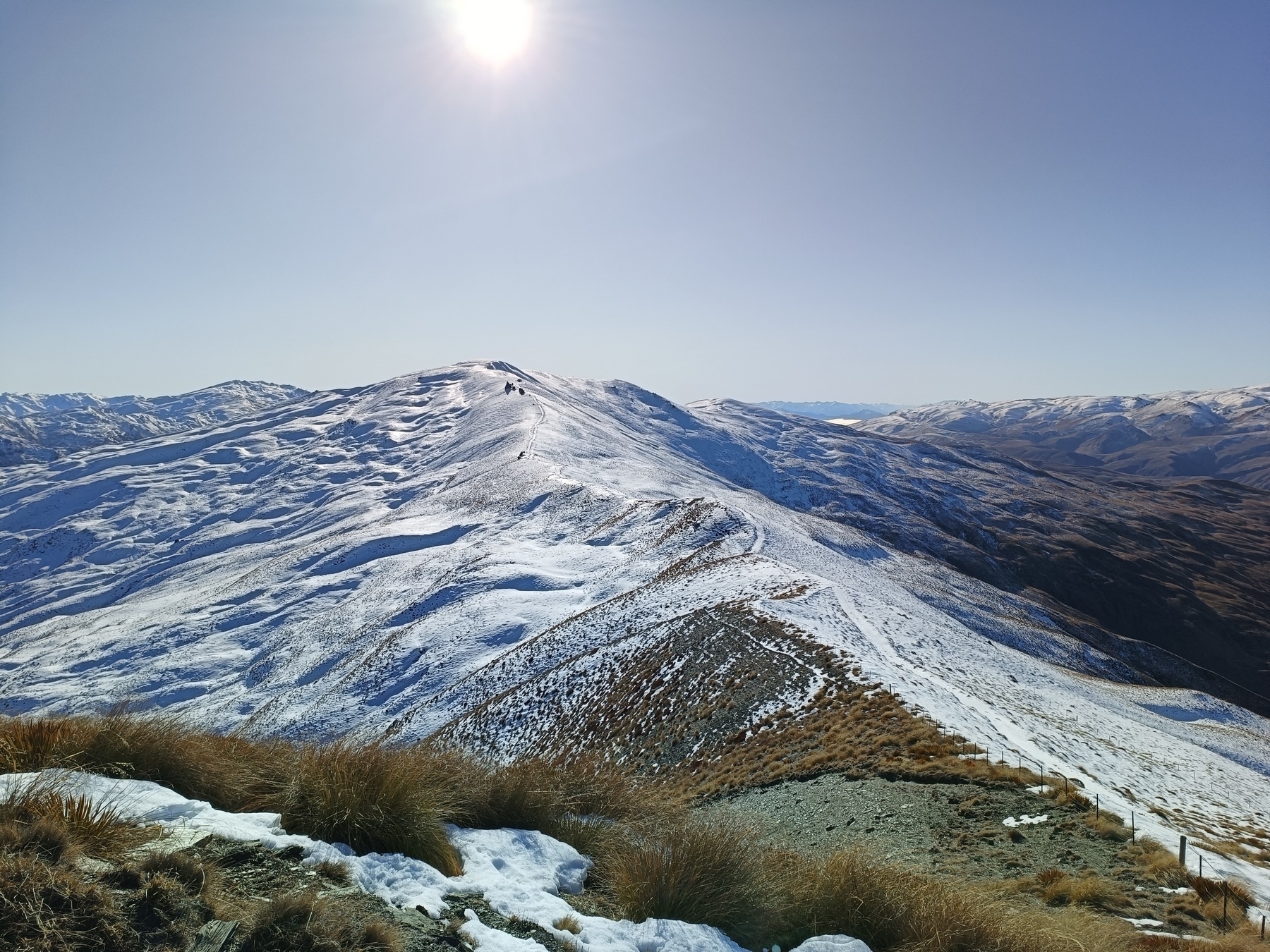
Peak 1 - Brow Peak (1,456m)
This is a regular for me. I’ve bagged this one probably 50 times from multiple directions. Given my car is parked at around 420m elevation I get just over 1,000m over a 7.6km round trip.
Peak 2 - A3KE (876m)
This is another regular where I do my grunty hill sessions up to the trig station. Although smaller, its still steep. This one gets me 430m over a 3.6km round trip.
The plan
My crude plan:

How it went
Great! Everything went swell. It was brisk in the mornings and evenings, but relatively comfortable. The cold kept me moving. I started at 8am, and around 3am the next morning when fatigue was hitting me the cold kept me moving.
Dad was in town and he paid me a visit around 6pm, 10 hours in. He rode my bike to come see me! Bloody trooper. That’s about a 30km round trip. Not bad for 70 years old. He was a bit drained though, 15k in. Luckily I had a boot full of snacks. We shared some electrolytes, had a laugh and went on our ways. Poor fella got a bit lost on the way back in the dark so had some stories himself the next day.
I hit the anticipated thought of quitting, laughed it off as planned, and kept on. 10 minutes later the thought had passed. The cold pizza was amazing (I made sure it lasted), as were the warm noodles. Having the boot was very handy.
The body held up well. Surprisingly not a single issue. I am however writing this now, 2 years later, injured with poor knees. Go figure.

Views from Brow Peak showing the change in conditions.
09:08
 11:54
11:54
 14:55
14:55
 18:12
18:12
 22:04
22:04

#trailrunning #bigslog
5 passes in a day
Date: 27 December, 2023 Location: Glenorchy, New Zealand
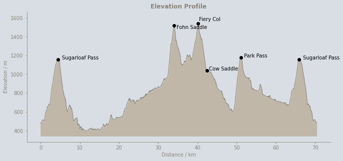
The goal was to complete the 5 Passes Route in one push. I was keen for a slog. The route is considered for experienced hikers, taking anywhere between 3-7 days. The terrain is slow, with multiple river crossings, bush bashing, alpine passes and navigation challenges. Perfect.
This would double as training for The Revenant which I had scheduled in a month later.
I kicked off at 4am knowing the first section would be easy in the dark, starting from the Routeburn Shelter as the bridge at Sylvan Campsite was down from flooding and the track to Lake Sylvan was closed. A bit annoying as I would’ve liked to do a full loop, but this way gave me the Sugarloaf Pass in both directions (6 passes?), so who am I to complain?
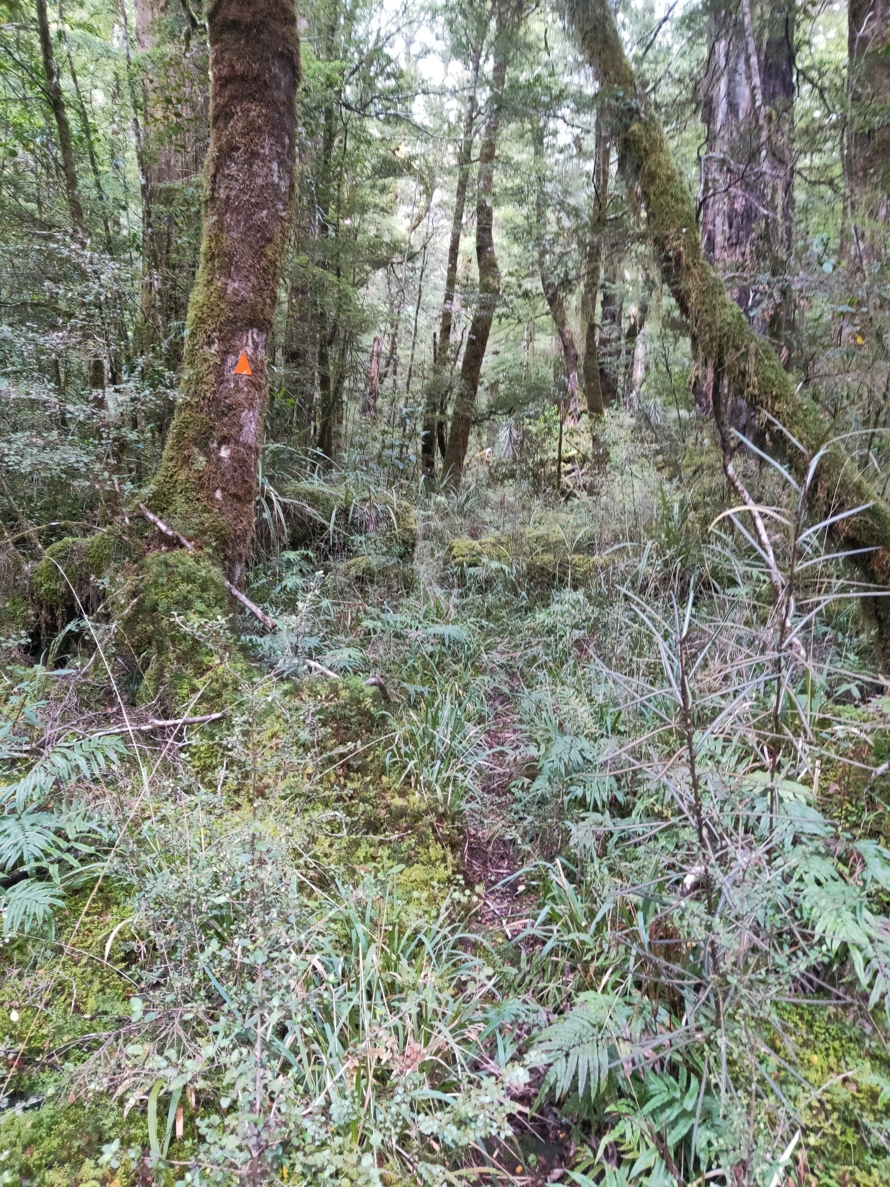
Amazing scenery the whole way. It was very tough going with not much runnable terrain. Feet were wet most of the way. Beans Burn was marked with triangles and cairns to where it opens up before Rock biv, though it was still easy to lose the track (which I did frequently).
The climbs were grueling as were the constant rivers, tussocks and boulders. The final descent from Sugarloaf at midnight, 20 hours after being on my feet, felt like an eternity.
Overall a successful day. A ripper of a challenge in some beautiful surroundings.
2 months later a couple of parties tackled the loop route for a Fastest Known Time (FKT). They came in at 20:08:42 and 22:28:02.
Crossing the river on Beans Burn Track
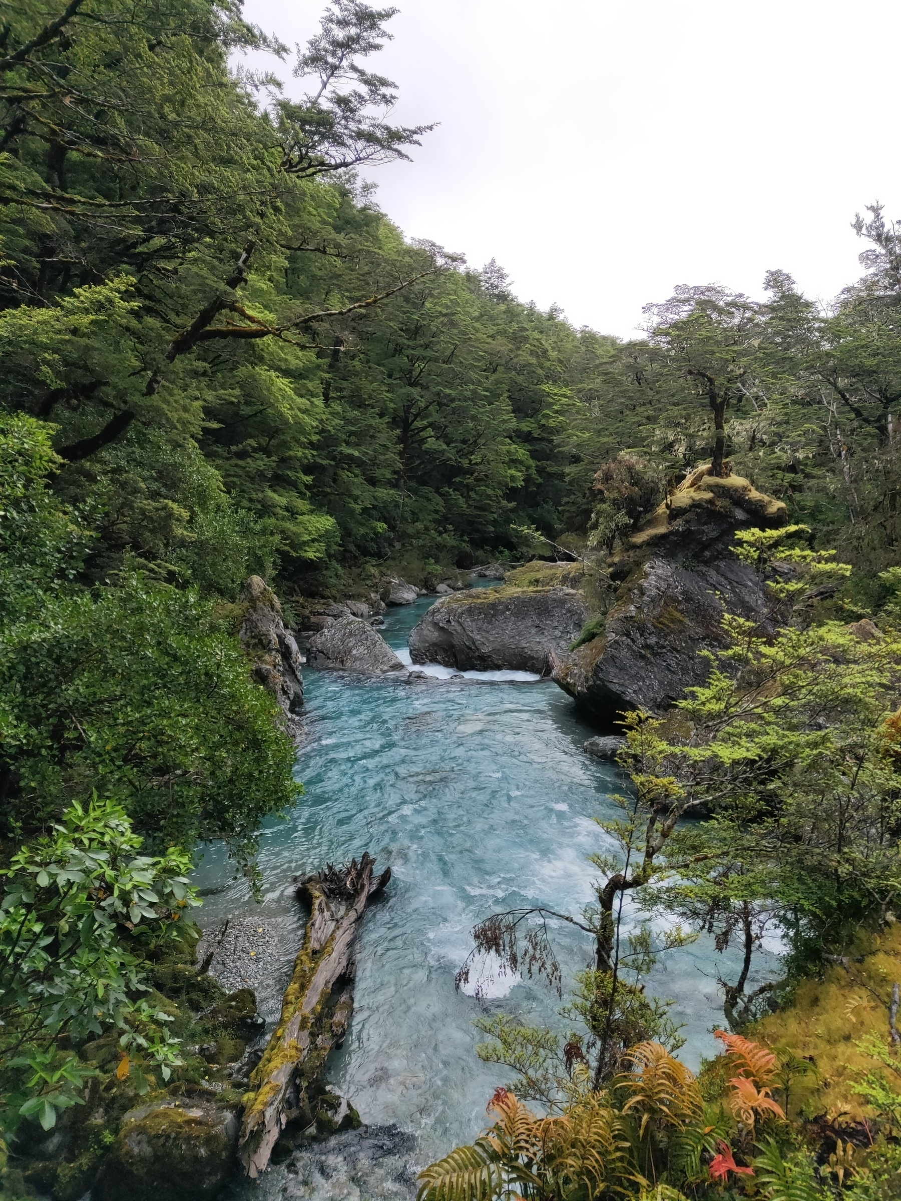
Useful markers along Beans Burn
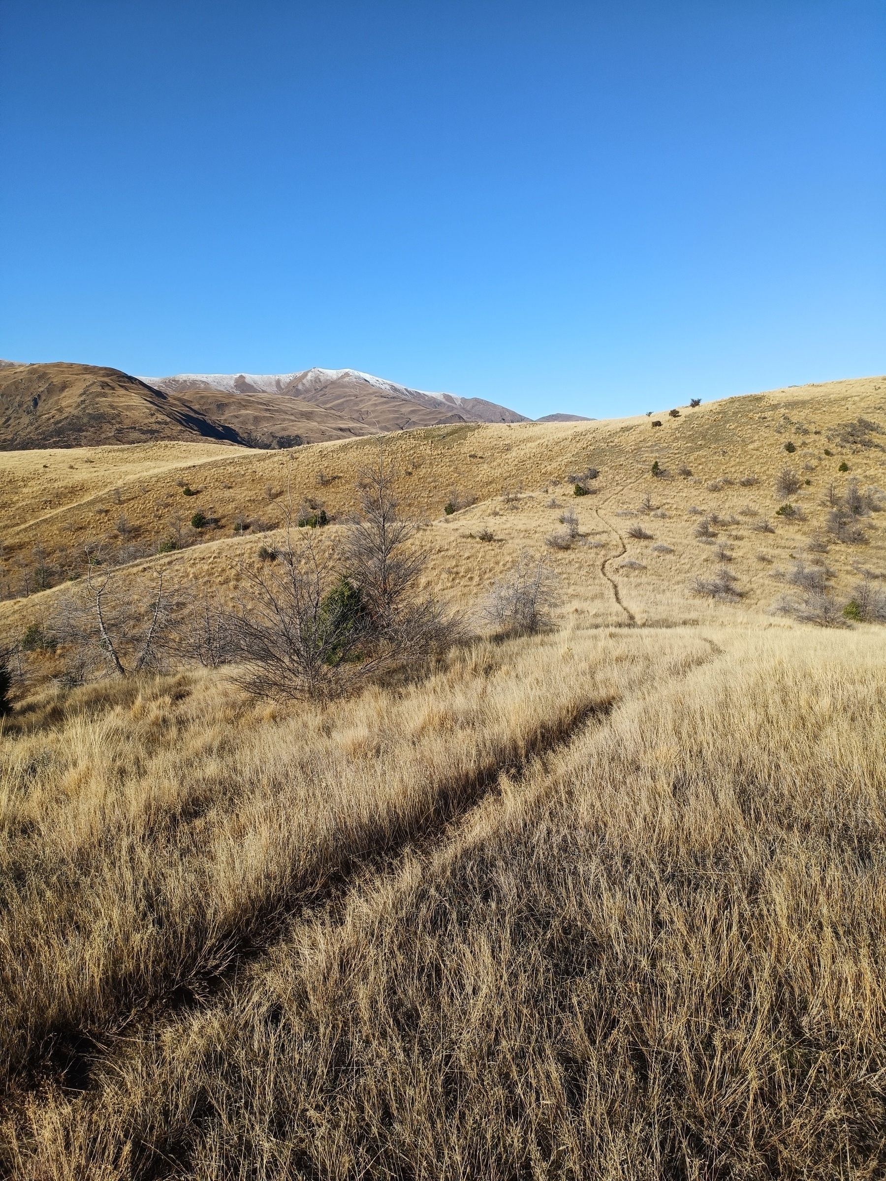
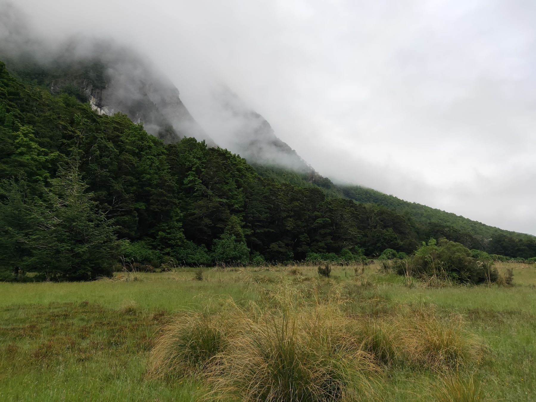
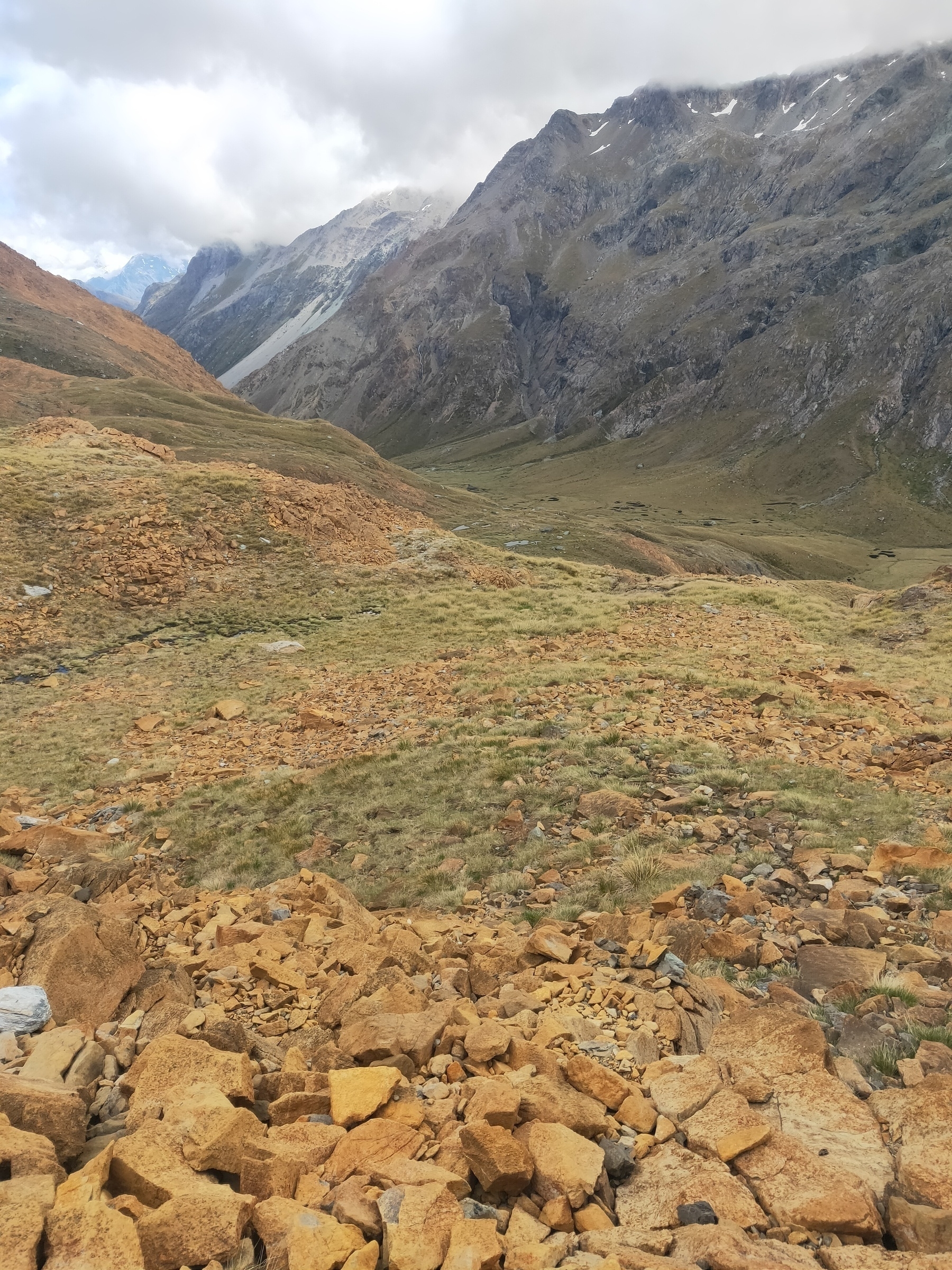
Occasional open plains
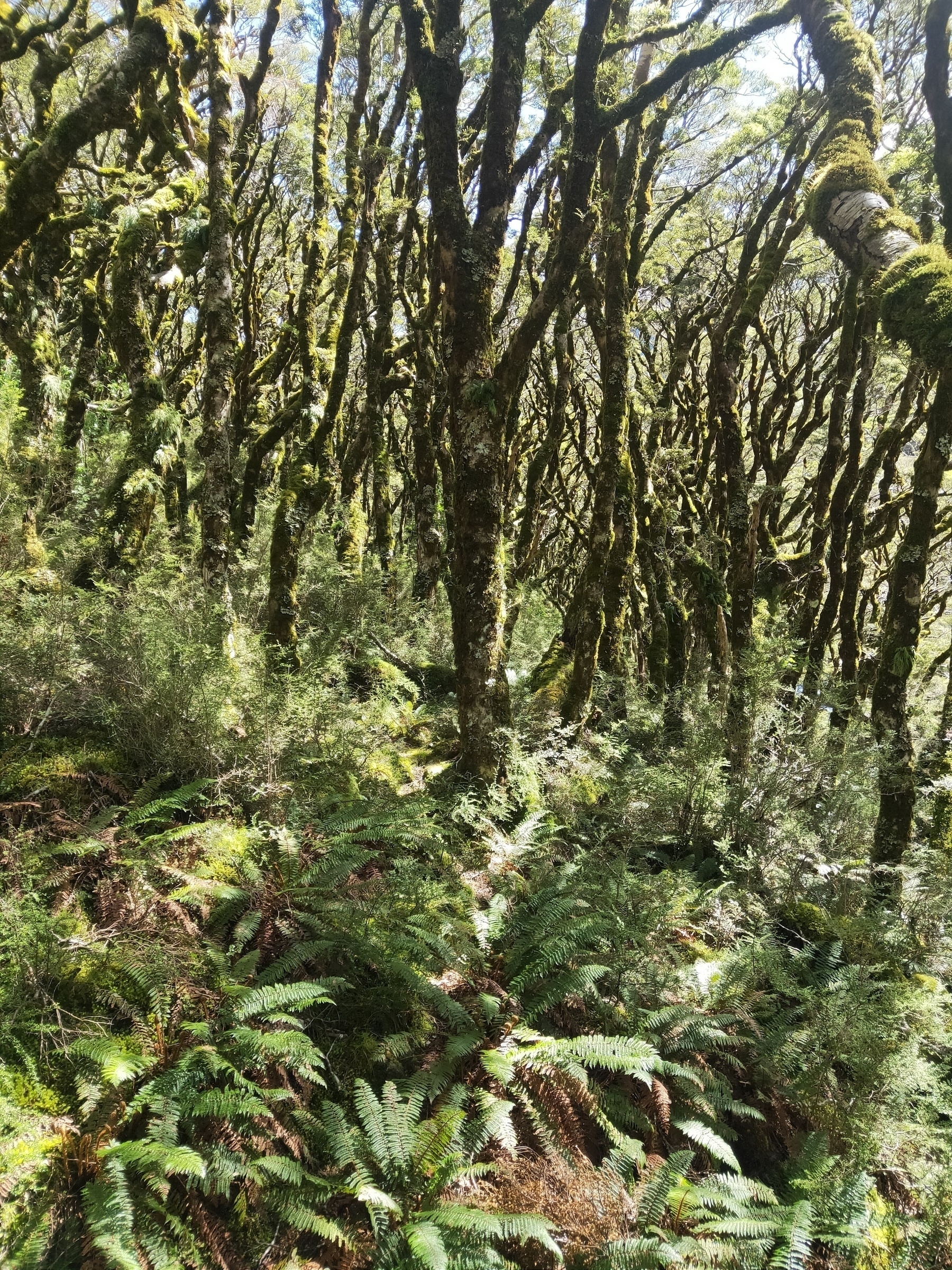
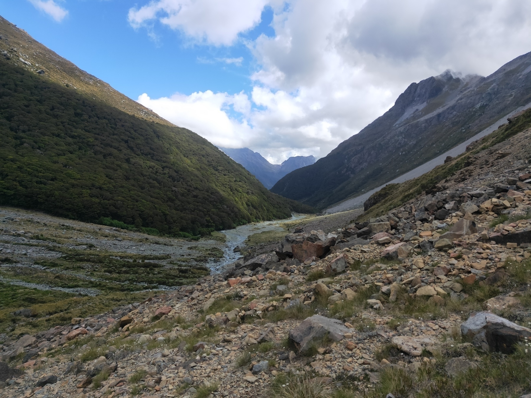
Somewhere along Beans Burn
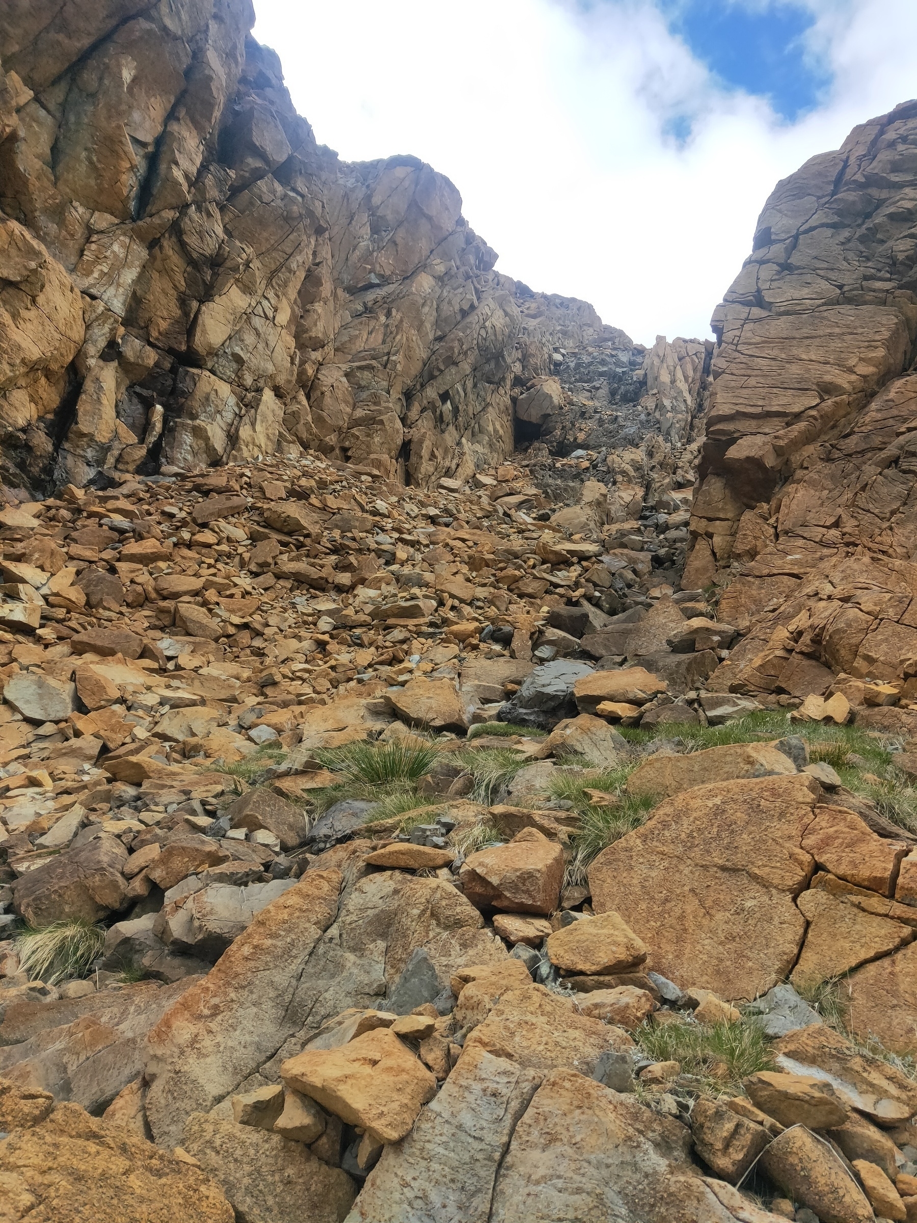
Track is somewhere in there
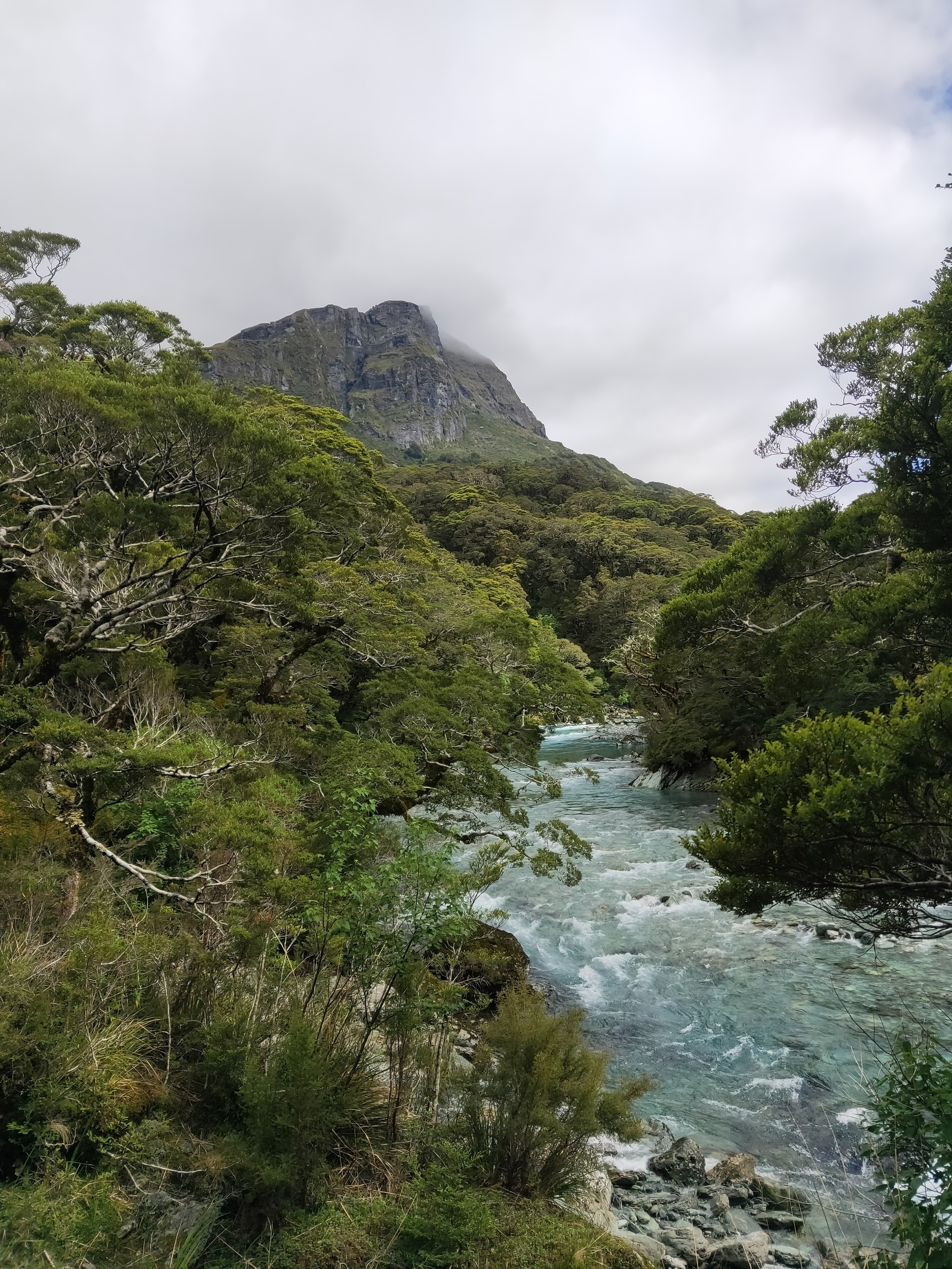
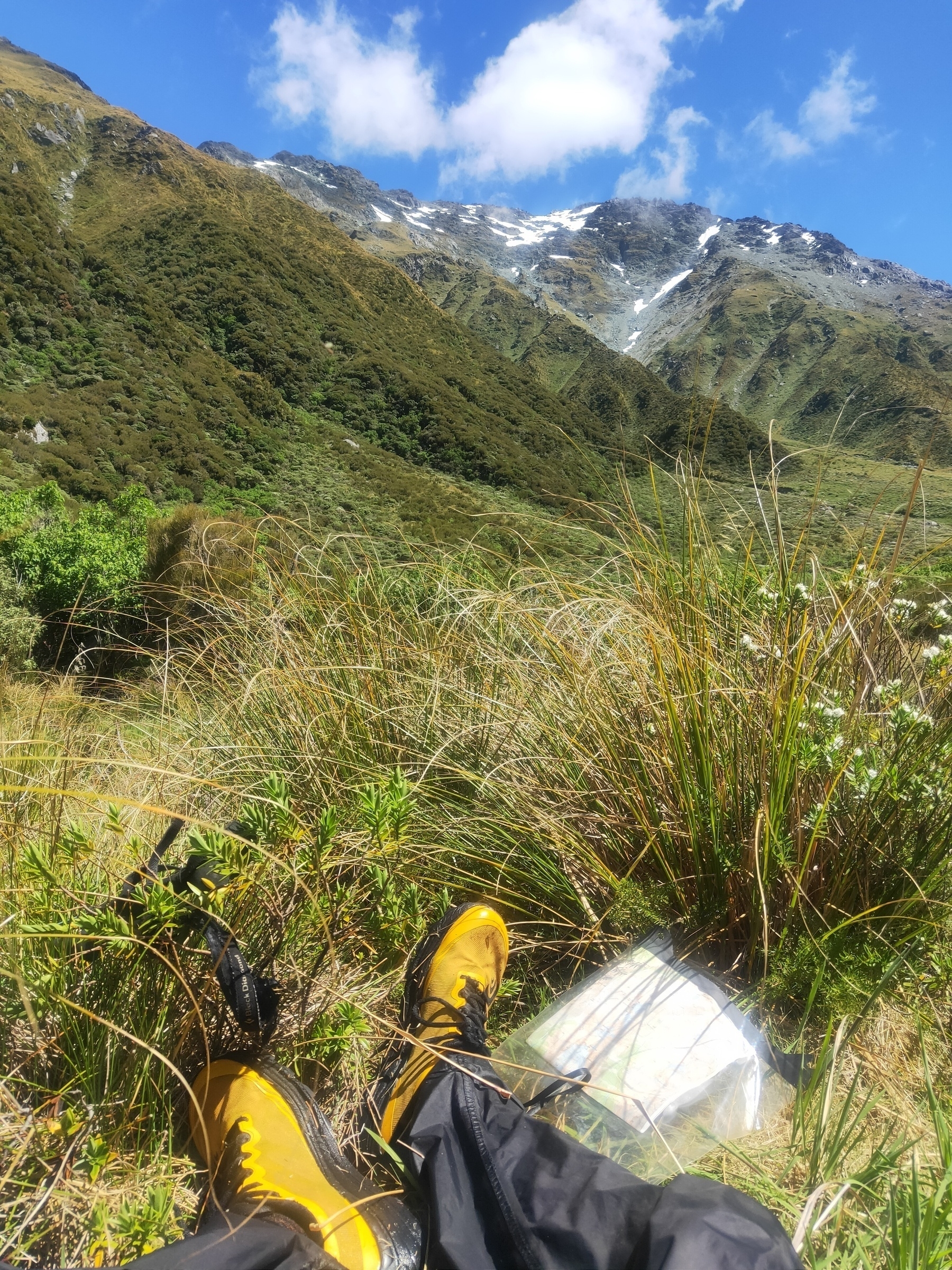
Knackered already and I’ve only done one pass. Fohn Saddle just around the bend
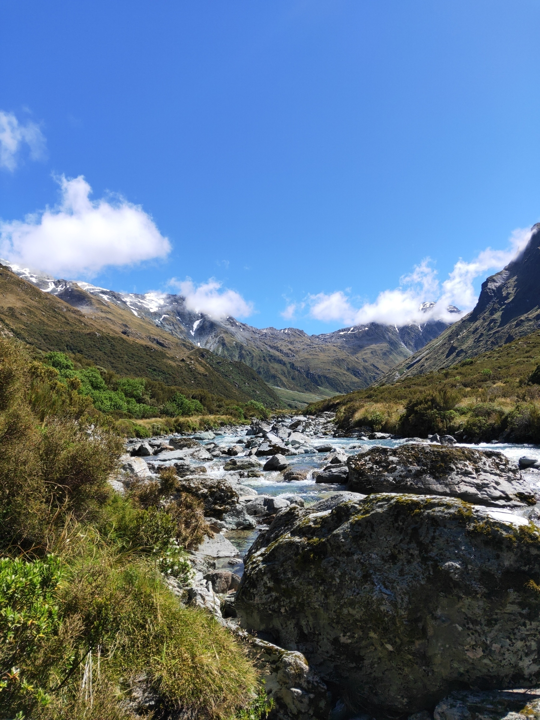
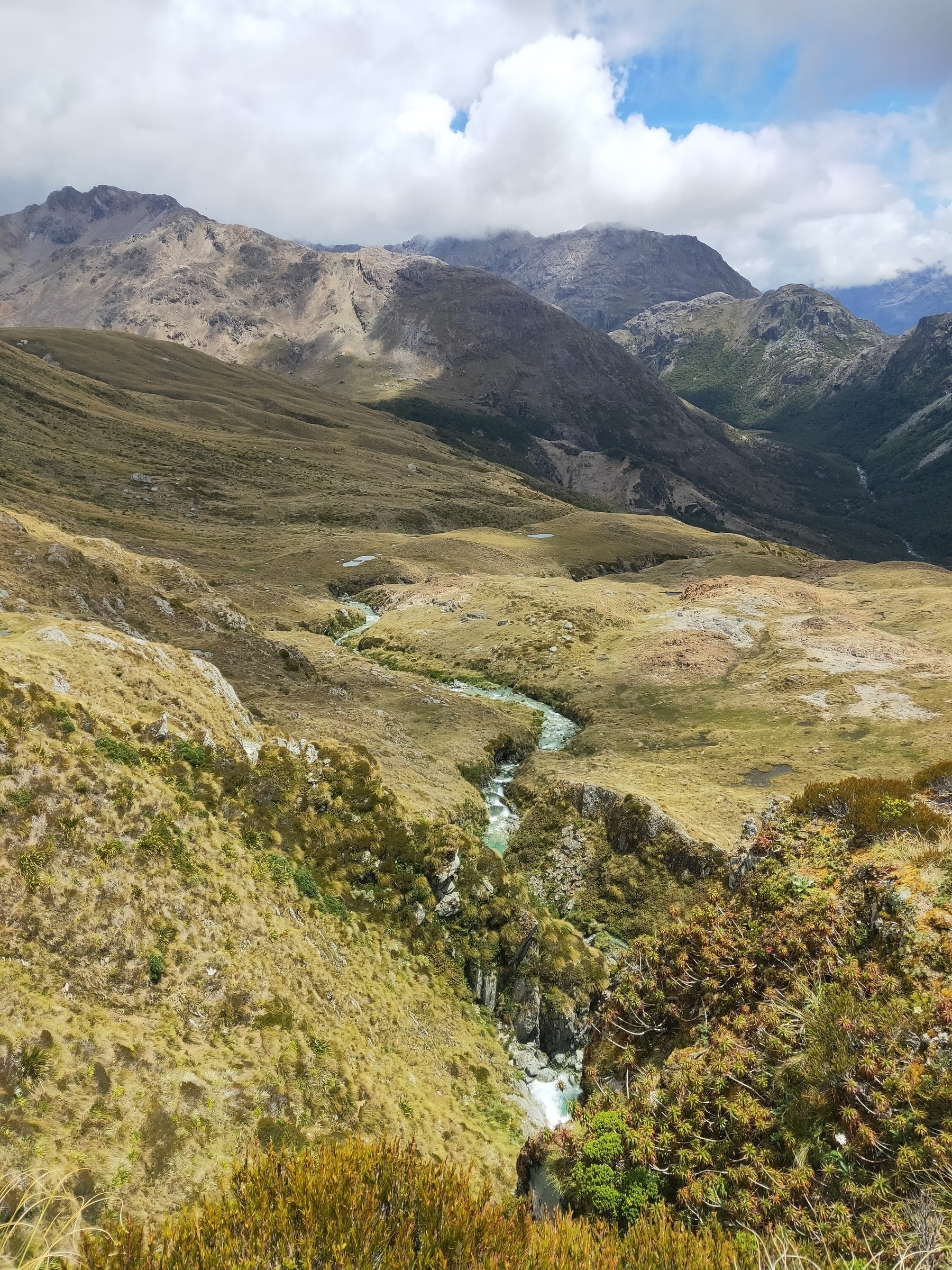
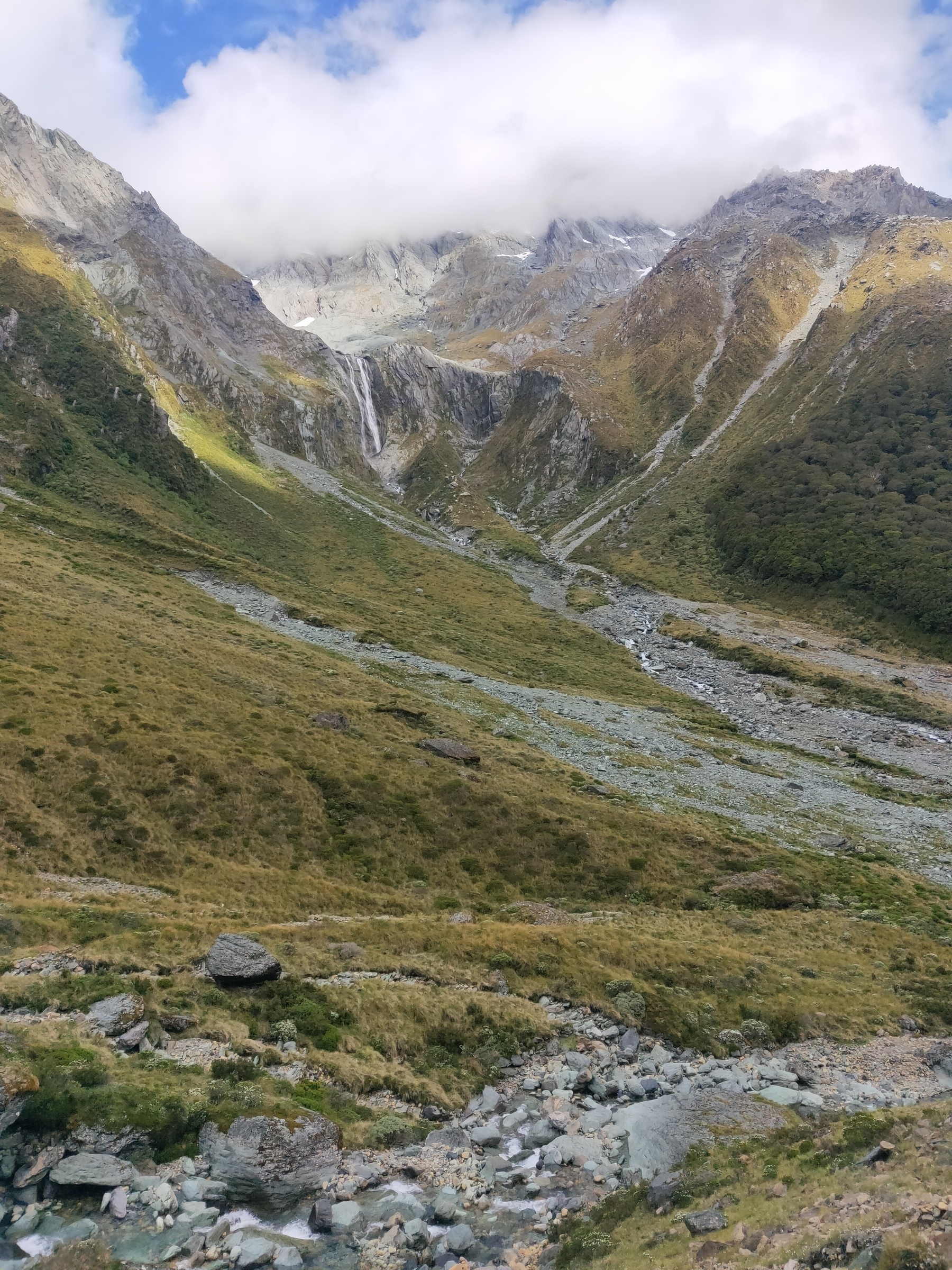
Looking up Beans Burn with Fohn Saddle in the distance
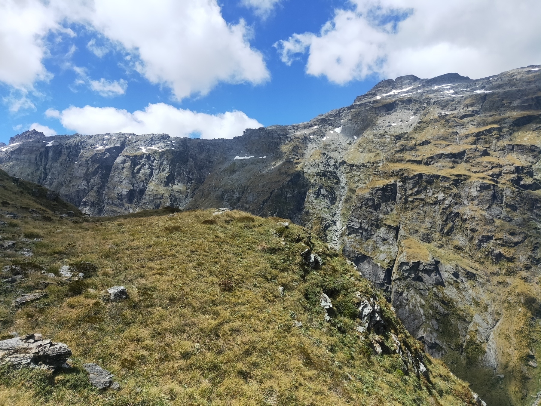
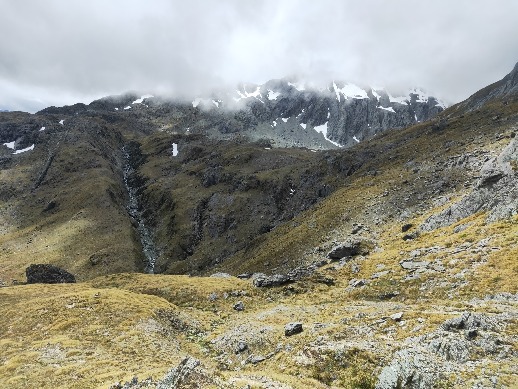
Walls of mountains, looking NE over Beans Burn from a higher altitude as I approach Fohn Saddle
Fohn Lakes and the outlet
Looking SW along the Fohn Lakes outlet with Fiery Col out of shot to the left
Approaching Fiery Col (left saddle)
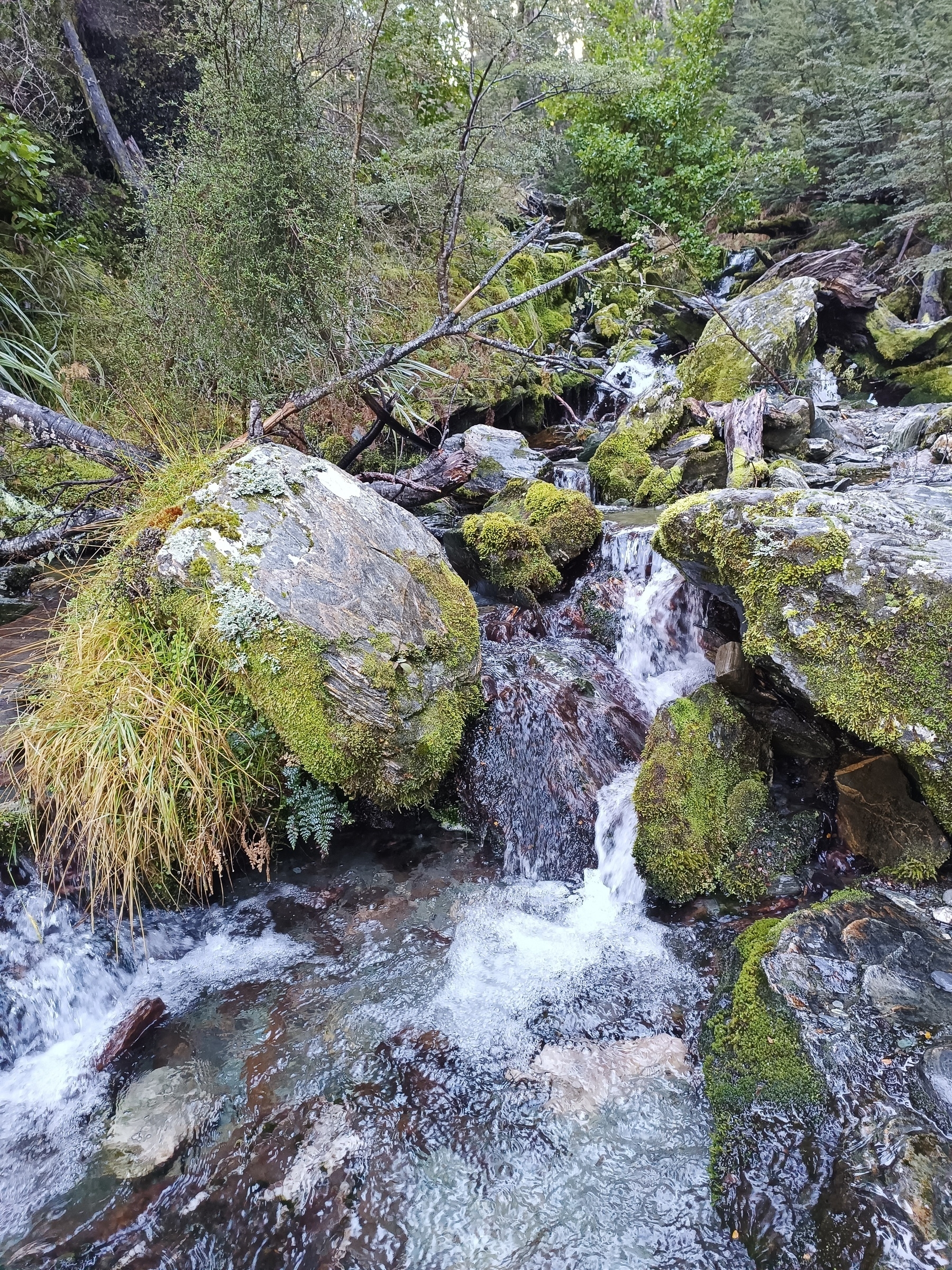
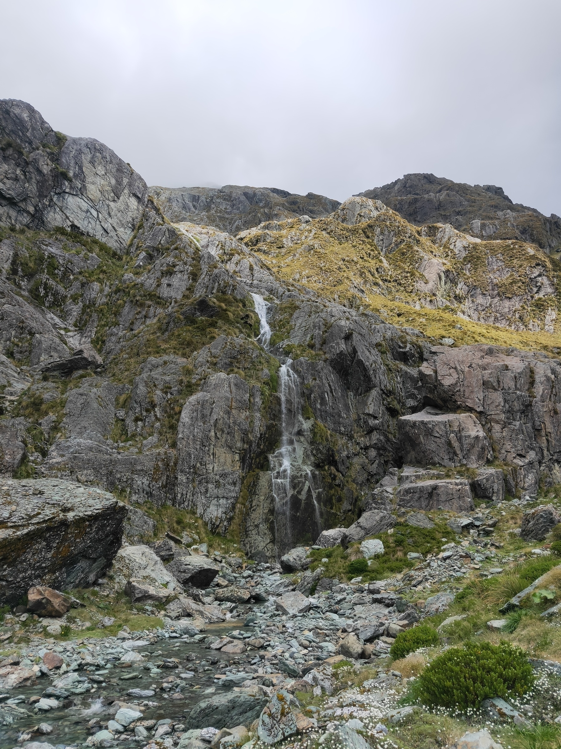
Passing a small waterfall approaching Fiery Col
Descending Fiery Col
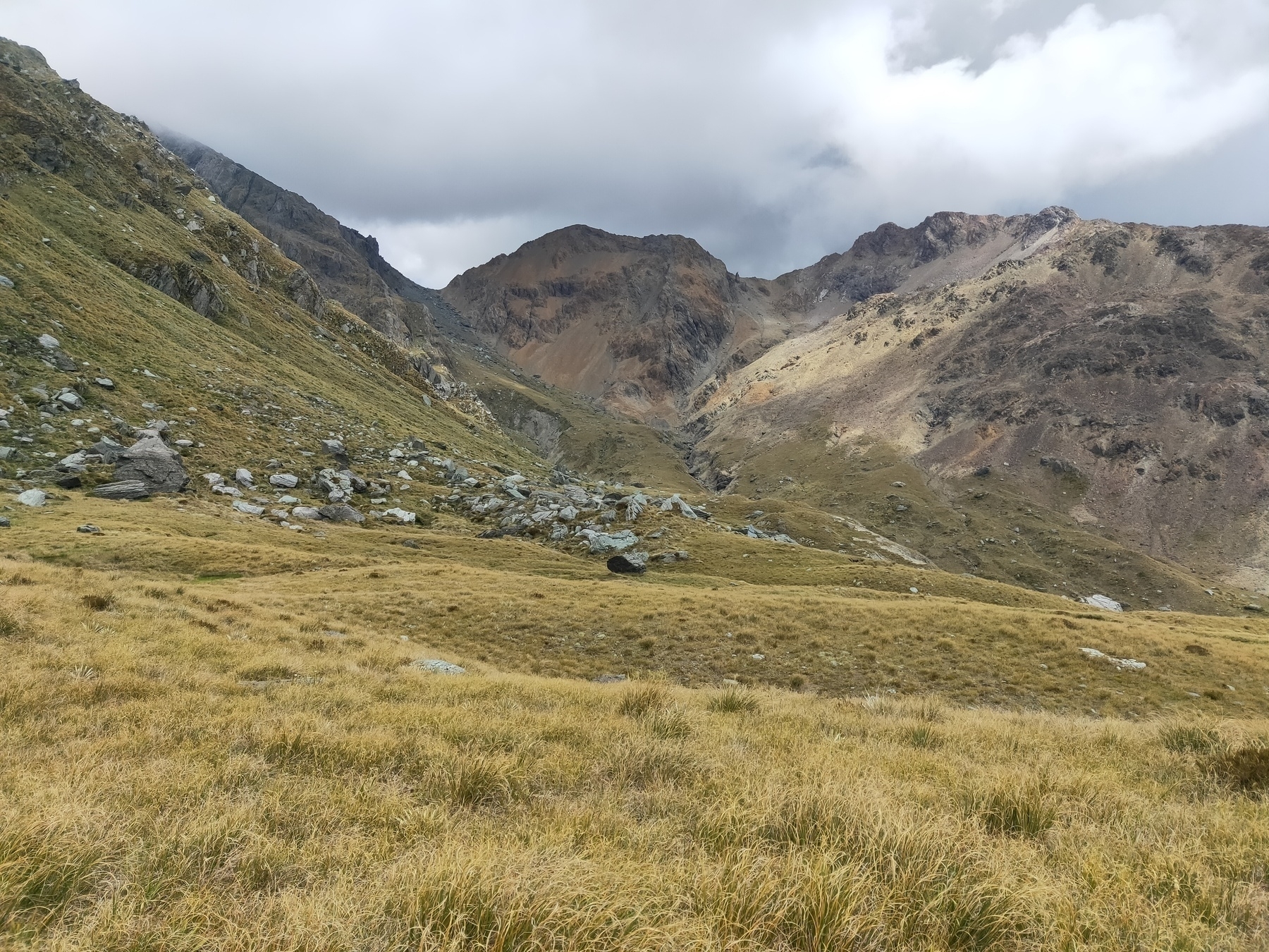
Approaching Cow Saddle
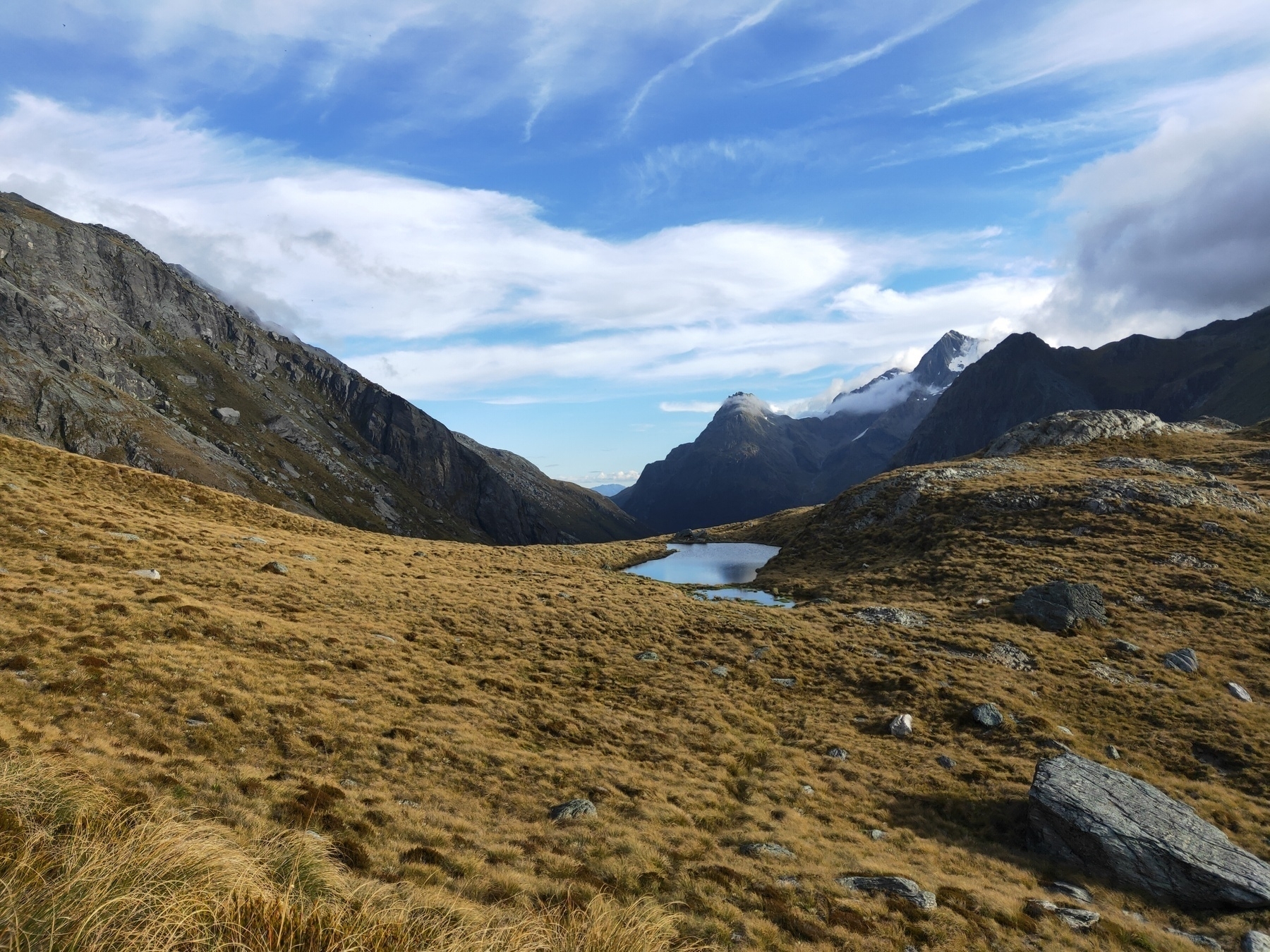
More mountain goodness
Looking down Hidden Falls Creek
Looking south over Park Pass, after an impressively steep climb
#trailrunning #bigslog