2024s
- Distance: 69.25km
- Elevation: 4,394m
- Moving Time: 13:42:31 (I was moving much longer, but I was so slow my watch didn’t notice)
- Elapsed Time: 20:59:14
- Distance: 15.73km
- Elevation: 512m
- Moving Time: 1:19:16
- Elapsed Time: 1:28:46
- Distance: 32.33km
- Elevation: 2,219m
- Moving Time: 8:43:08
- Elapsed Time: 9:18:29
- Distance: 16.51km
- Elevation: 789m
- Moving Time: 1:44:45
- Elapsed Time: 2:00:43
-
🏃♂️ Ran 45.4km/2,651m - Getting close to my sweet spot again. Even threw in a grinding 2min-on/ 1min-off hill session. Got back into my scrub bashing habits too. Gotta be careful with my knees. They’ve seen better days.
-
💻 Learnt how to create maps and elevation profiles with my gpx files. Maps are exported to html so I can embed in my notes/posts.
-
💻 Satisfied with micro.blog as my webspace. It’s just what I was after - easy posting from mobile and PC, seamless cross-posting to Mastodon, and some nice looking styling templates for the website. I can pull my long-posts (not short-posts?) back into Obsidian using the RSS Reader plugin. Looks like there’s a micro.publish plugin that goes the other direction, posting to micro.blog from Obsidian. I’ll look at this later.
-
📅📈 Attended a trading webinar by Society of Technical Analysts of New Zealand (STANZ). The topic was on Elliot Waves, a form of technical analysis I find interesting but very hard to put into practice.
-
📅 Went to Luma Southern Light Project. First time since 2019. Was ok but not really my thing.
-
📚 Finished reading Data Grab (2024) by Ulises A. Mejias and Nick Couldry ⭐⭐⭐. Very well researched book. A good snapshot of the state of data ownership, but found the ways forward aimed at more involved activists and developers rather than the average Joe.
- Monday - King’s birthday public holiday. Garden time.
- Adz visiting on Friday 🍻
- Junited 2024 is underway which will give me some nice reading material.
- Inspired by @CodeMacLife’s WeBlogPomo reflection post I’m going to try scaling back the coffee (5 a day is not good right?).
- Go to bed earlier.
- Continue my early starts.
- Ride to work.
5 passes in a day
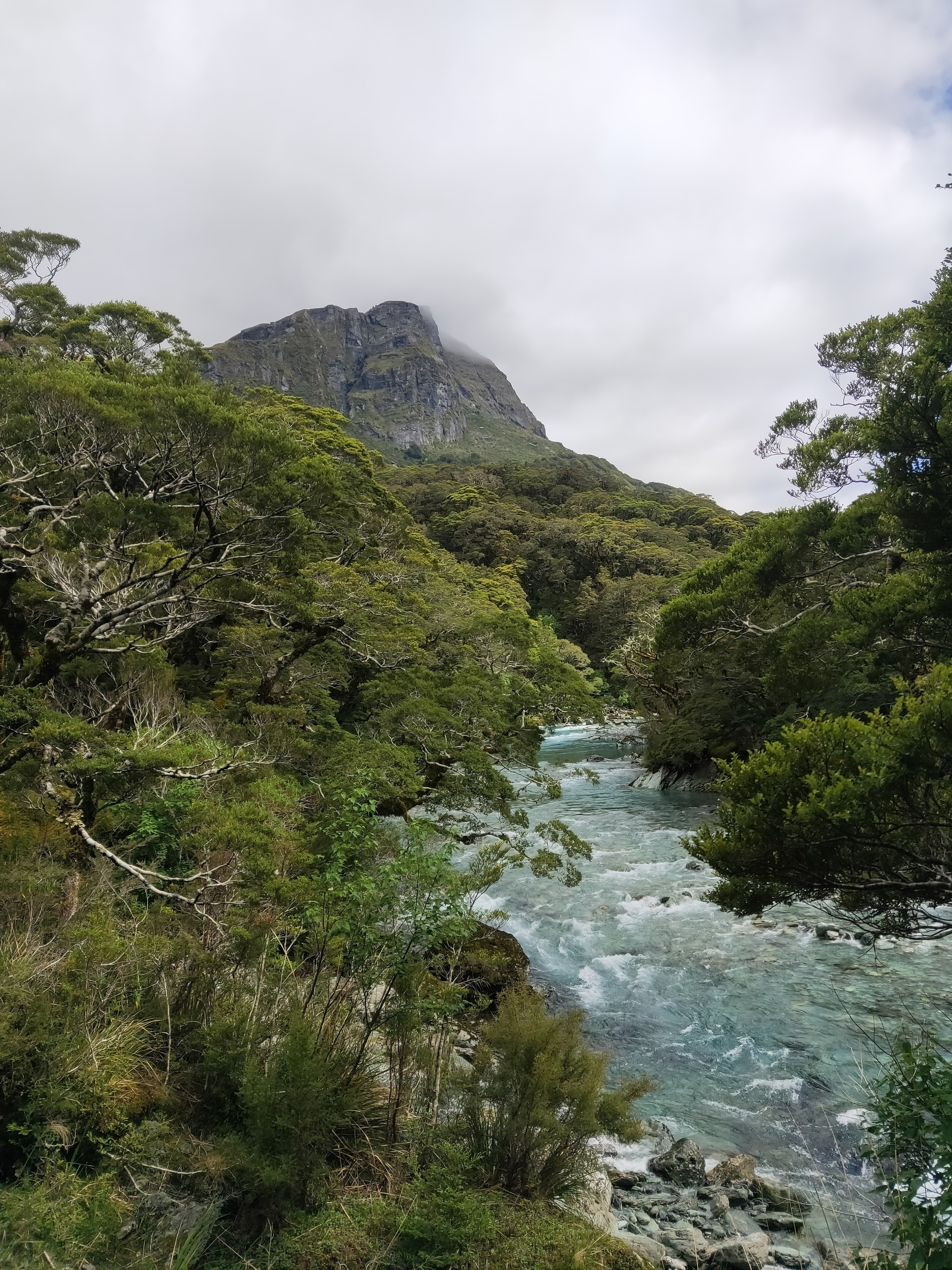
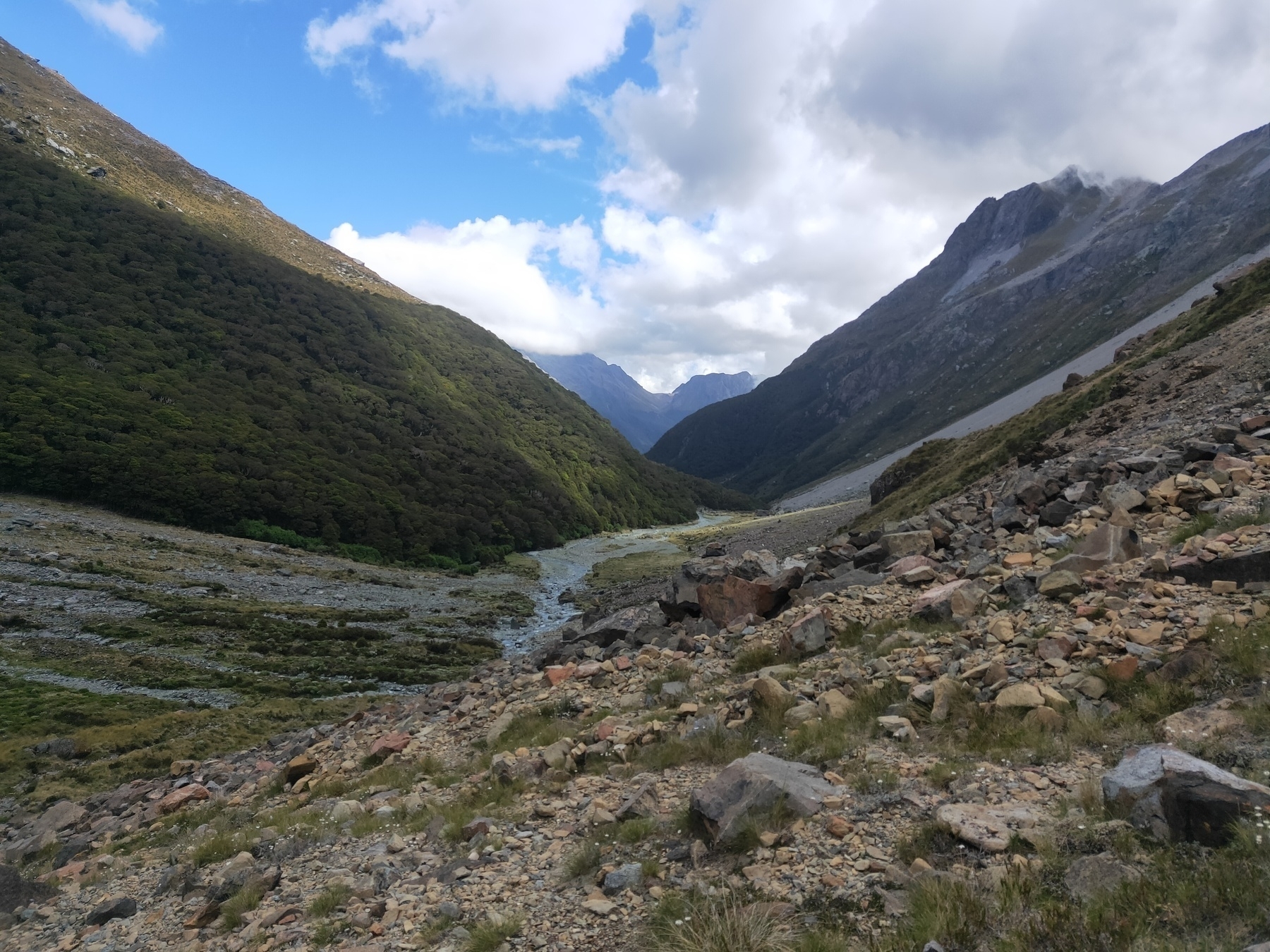
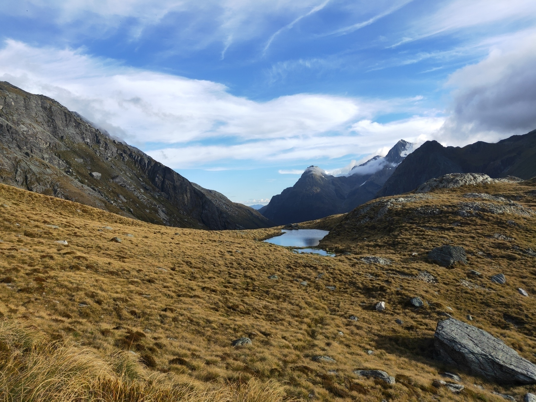
Date: 27 December, 2023 Location: Glenorchy, New Zealand
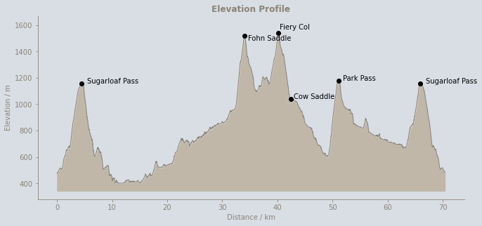
The goal was to complete the 5 Passes Route in one push. I was keen for a slog. The route is considered for experienced hikers, taking anywhere between 3-7 days. The terrain is slow, with multiple river crossings, bush bashing, alpine passes and navigation challenges. Perfect.
This would double as training for The Revenant which I had scheduled in a month later.
I kicked off at 4am knowing the first section would be easy in the dark, starting from the Routeburn Shelter as the bridge at Sylvan Campsite was down from flooding and the track to Lake Sylvan was closed. A bit annoying as I would’ve liked to do a full loop, but this way gave me the Sugarloaf Pass in both directions (6 passes?), so who am I to complain?
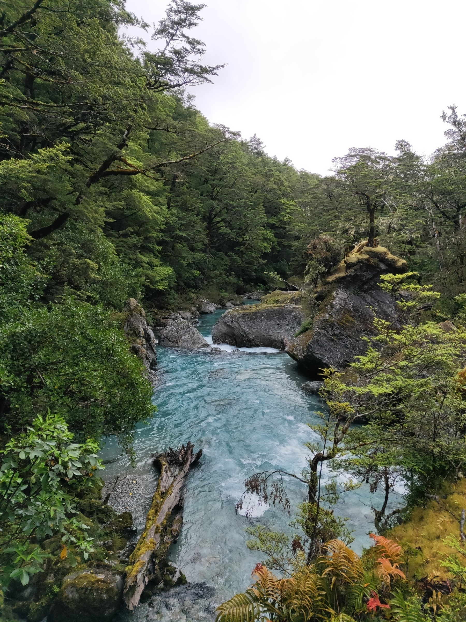
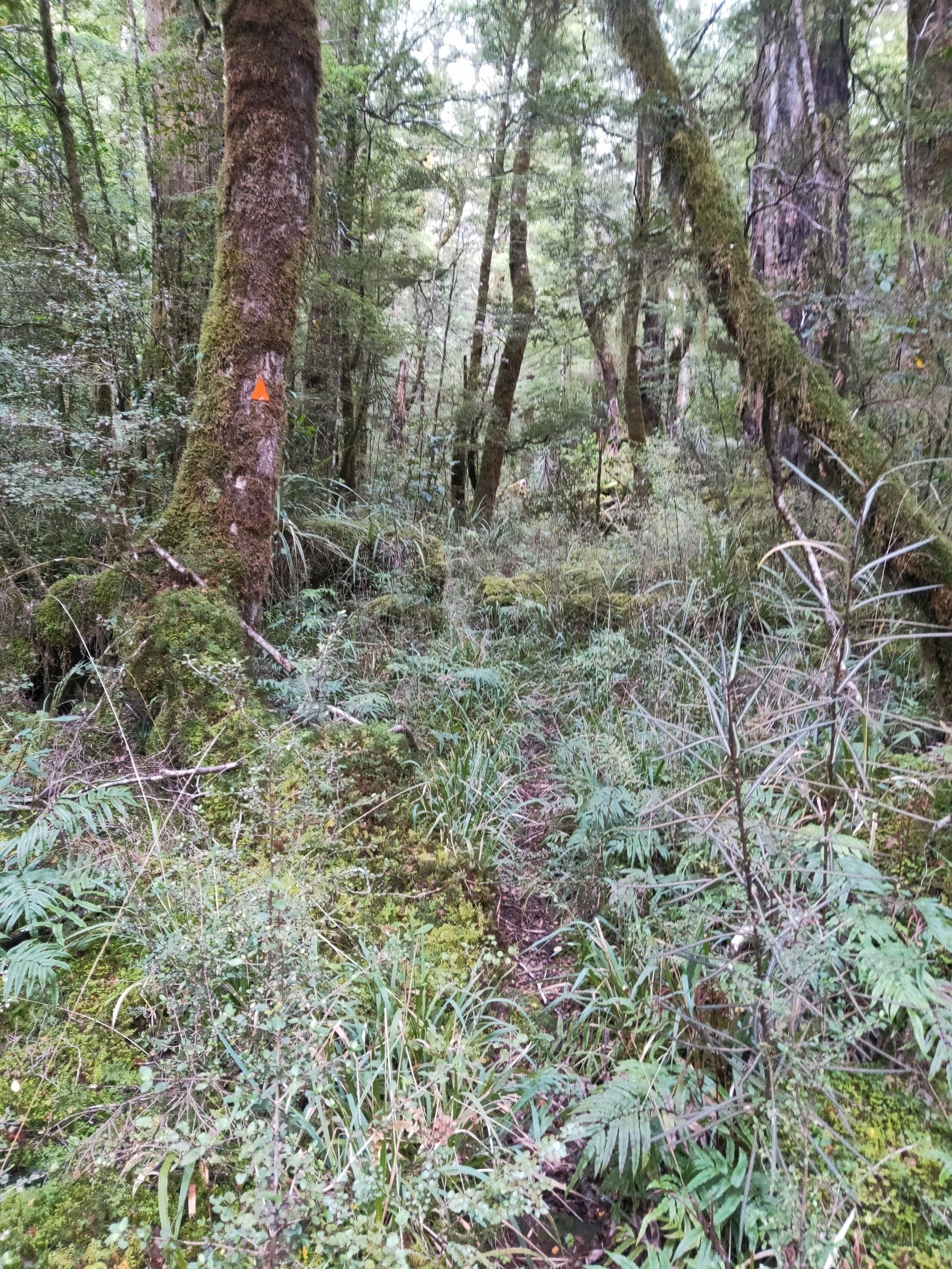
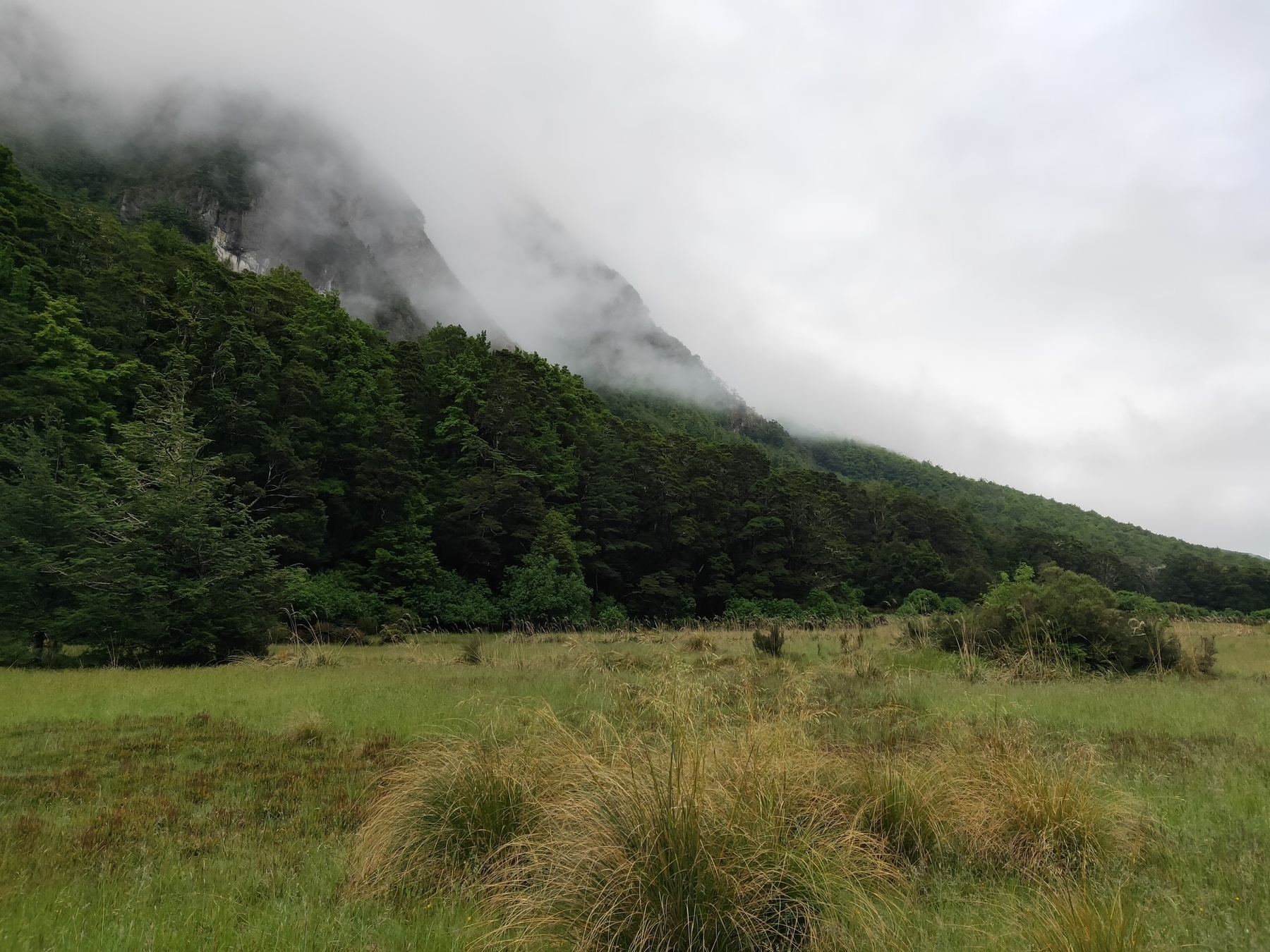
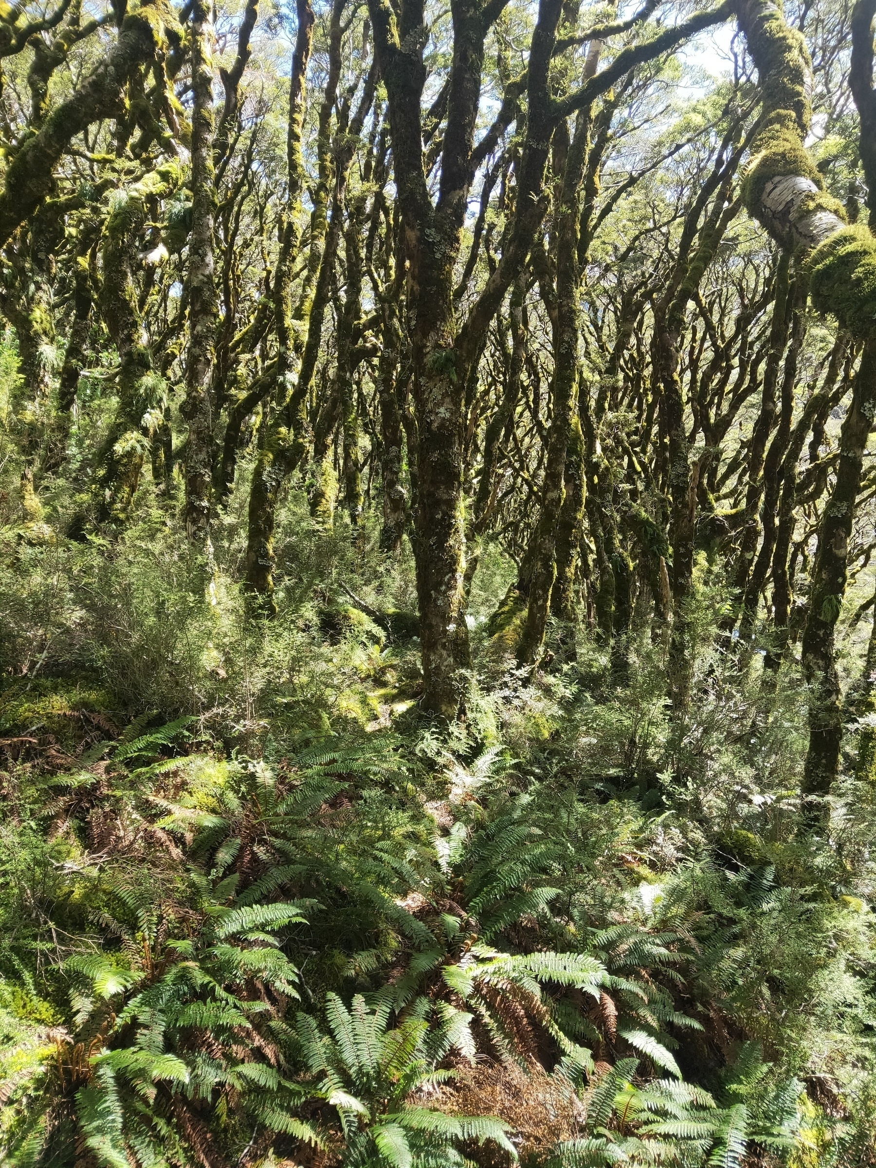
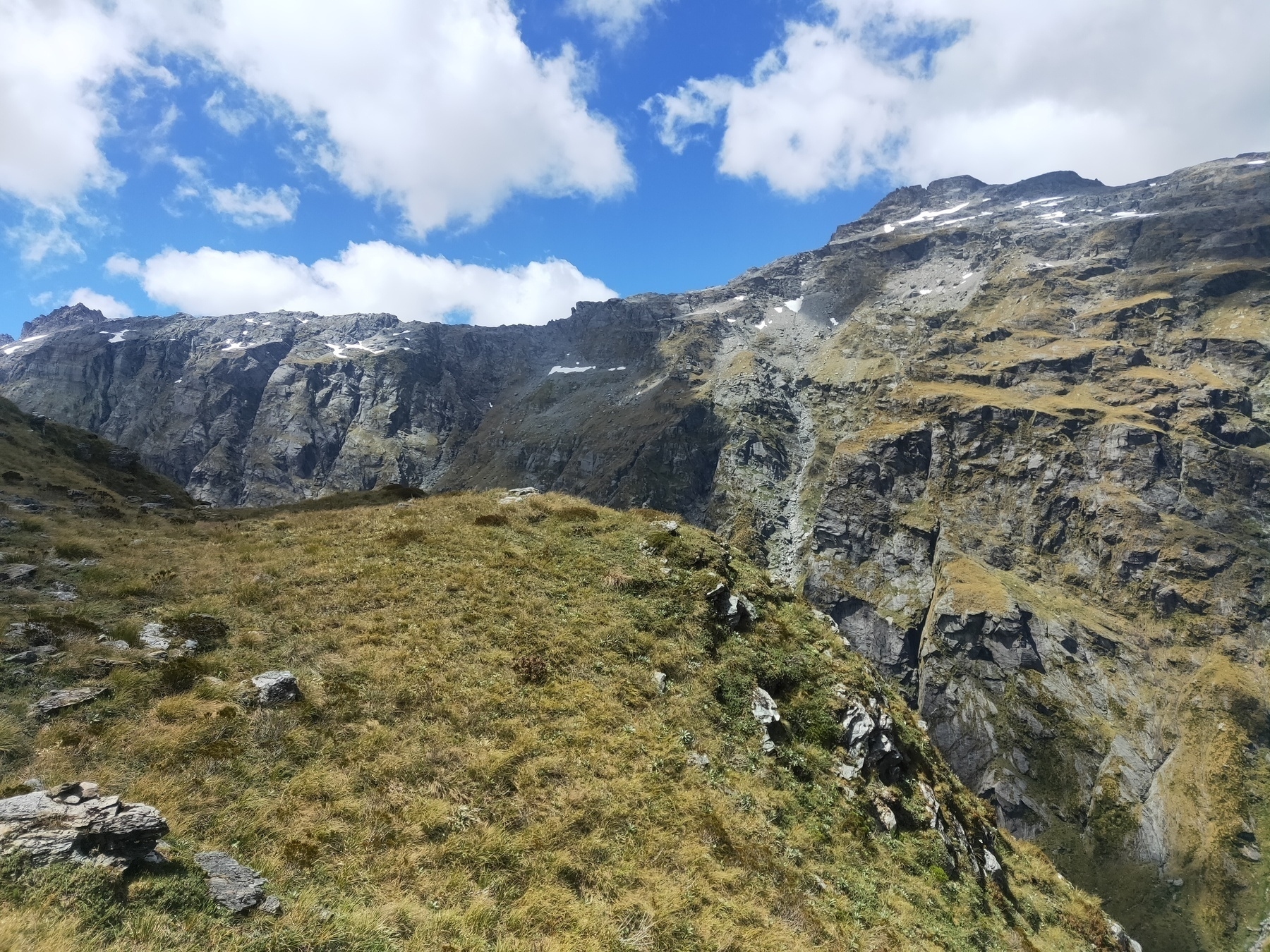
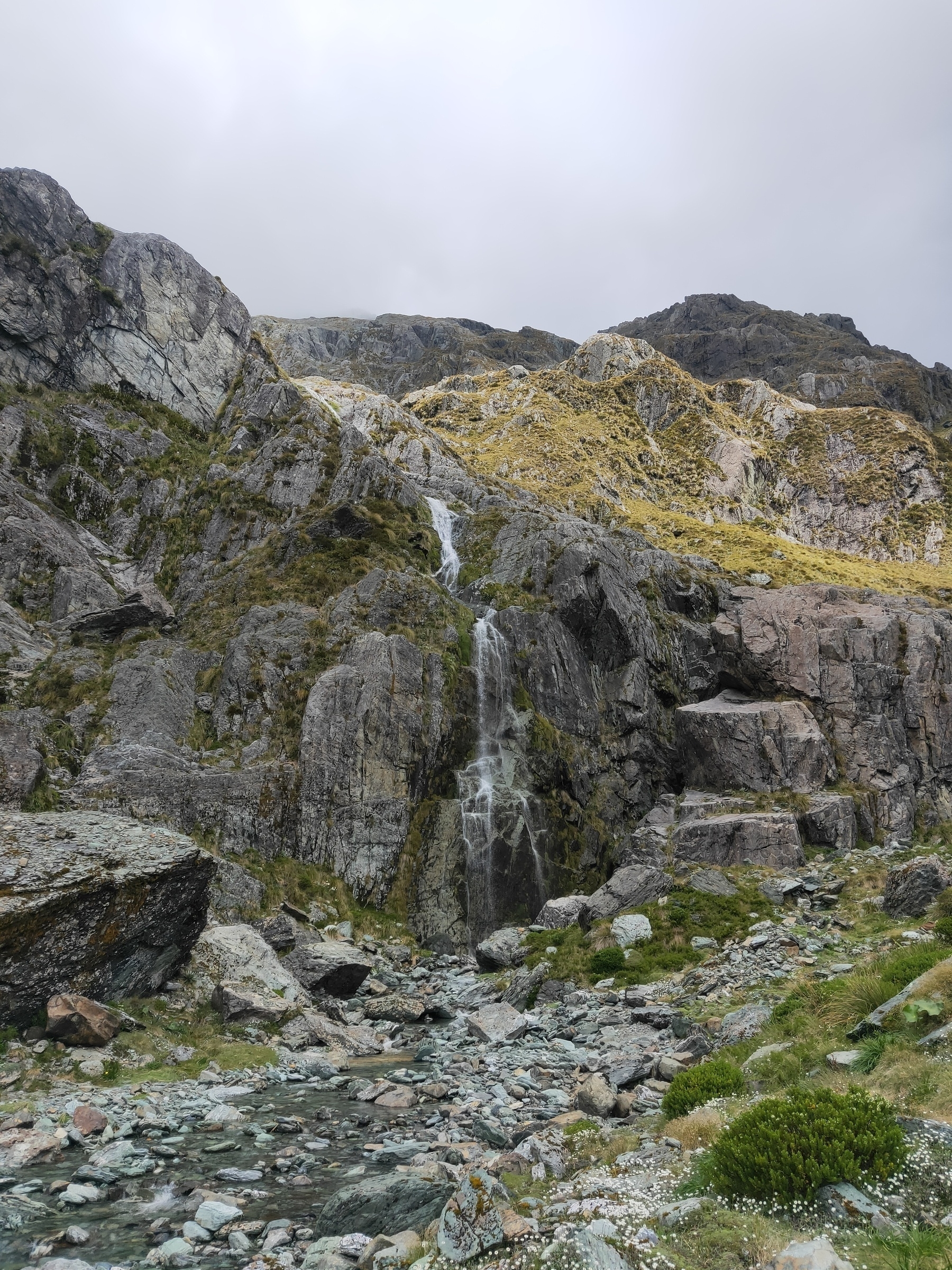
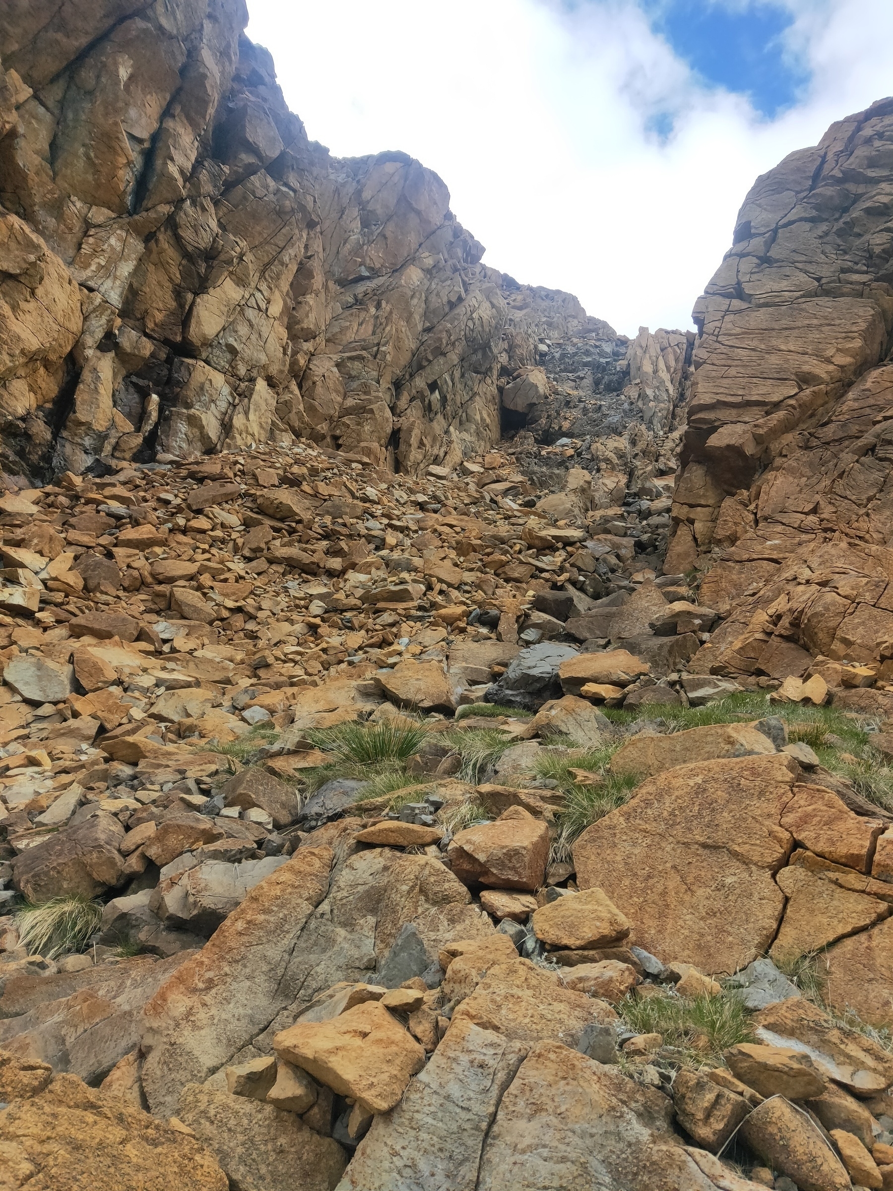
Amazing scenery the whole way. It was very tough going with not much runnable terrain. Feet were wet most of the way. Beans Burn was marked with triangles and cairns to where it opens up before Rock biv, though it was still easy to lose the track (which I did frequently).
The climbs were grueling as were the constant rivers, tussocks and boulders. The final descent from Sugarloaf at midnight, 20 hours after being on my feet, felt like an eternity.
Overall a successful day. A ripper of a challenge in some beautiful surroundings.
2 months later a couple of parties tackled the loop route for a Fastest Known Time (FKT). They came in at 20:08:42 and 22:28:02.
Crossing the river on Beans Burn Track
Useful markers along Beans Burn
Occasional open plains
Somewhere along Beans Burn
Track is somewhere in there
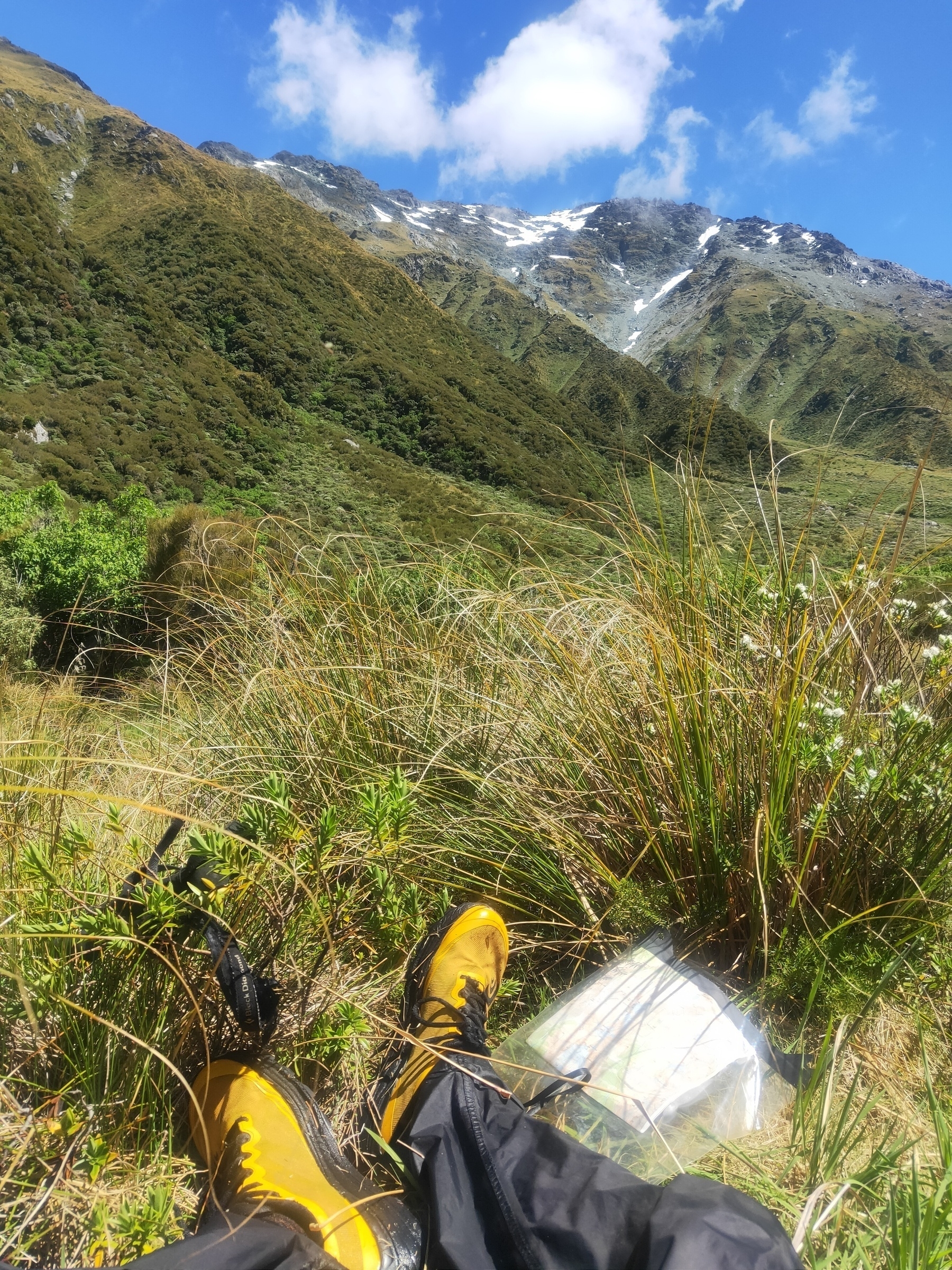
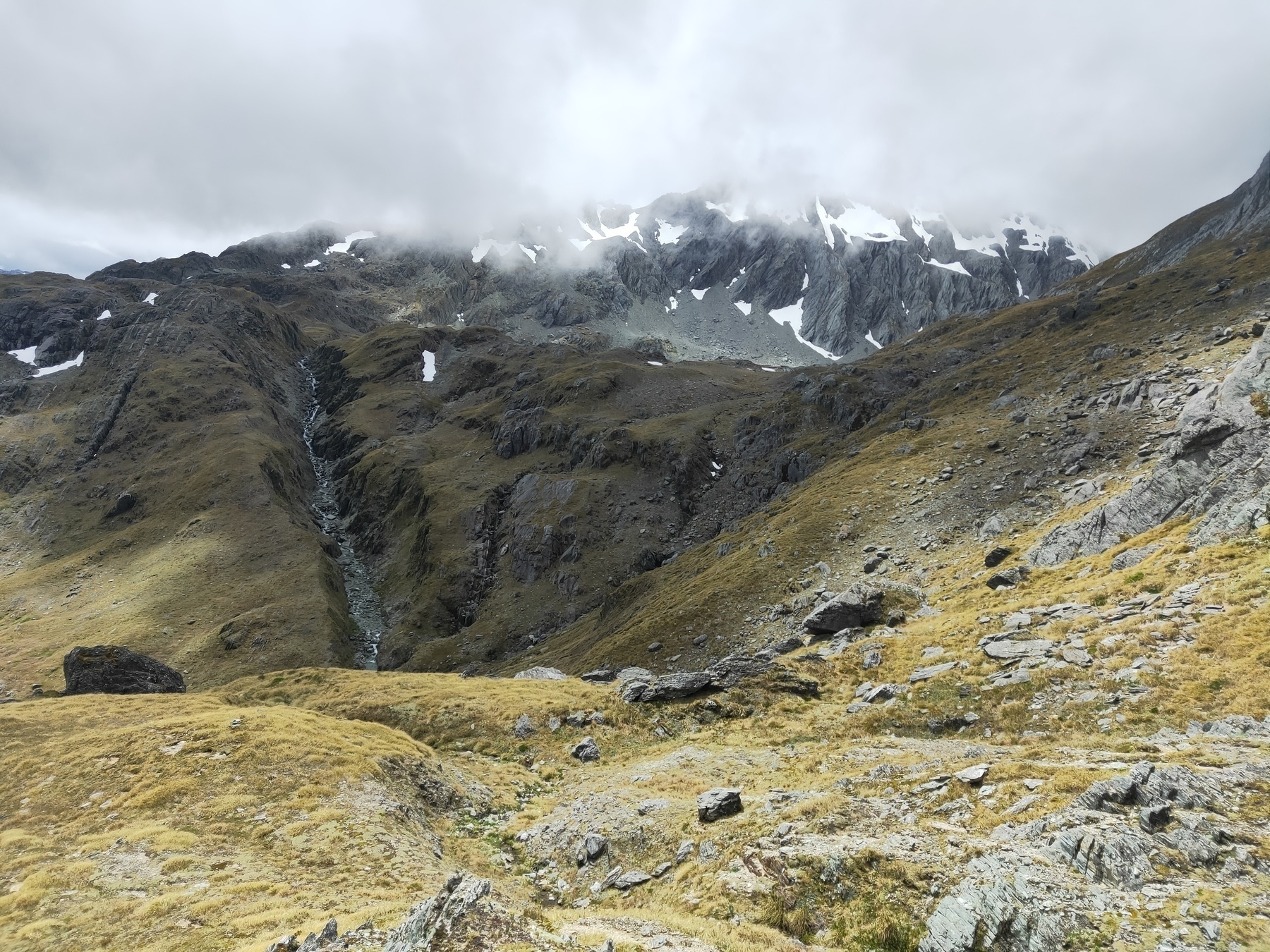
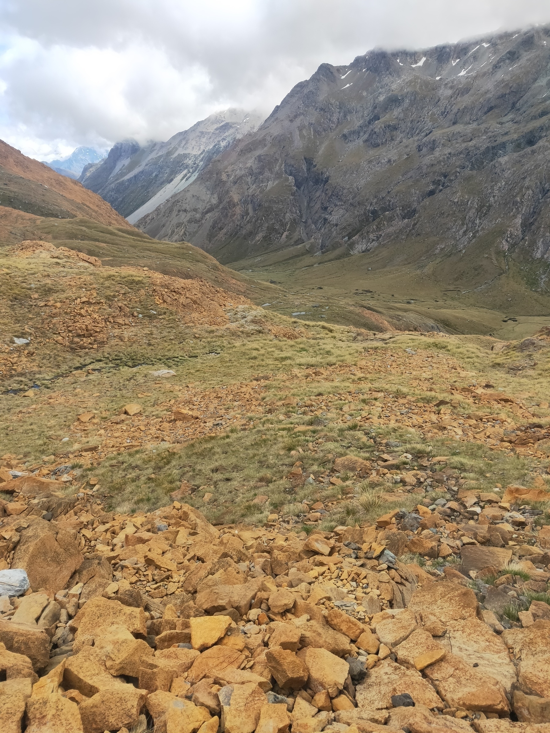
Knackered already and I’ve only done one pass. Fohn Saddle just around the bend
Looking up Beans Burn with Fohn Saddle in the distance
Walls of mountains, looking NE over Beans Burn from a higher altitude as I approach Fohn Saddle
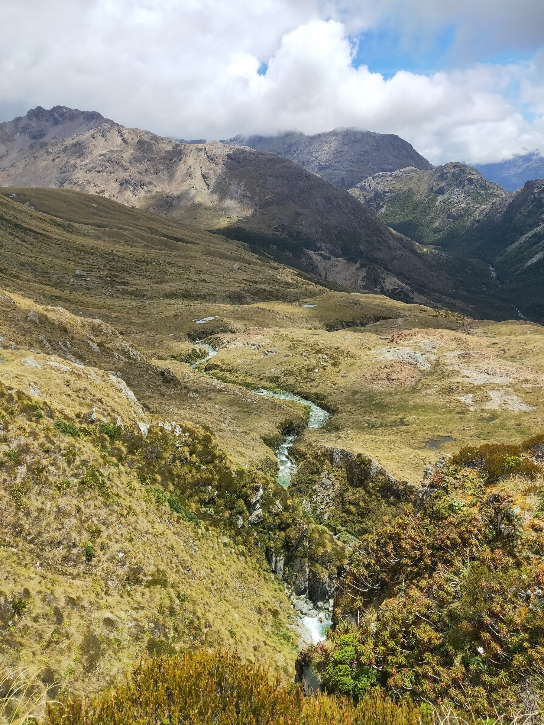
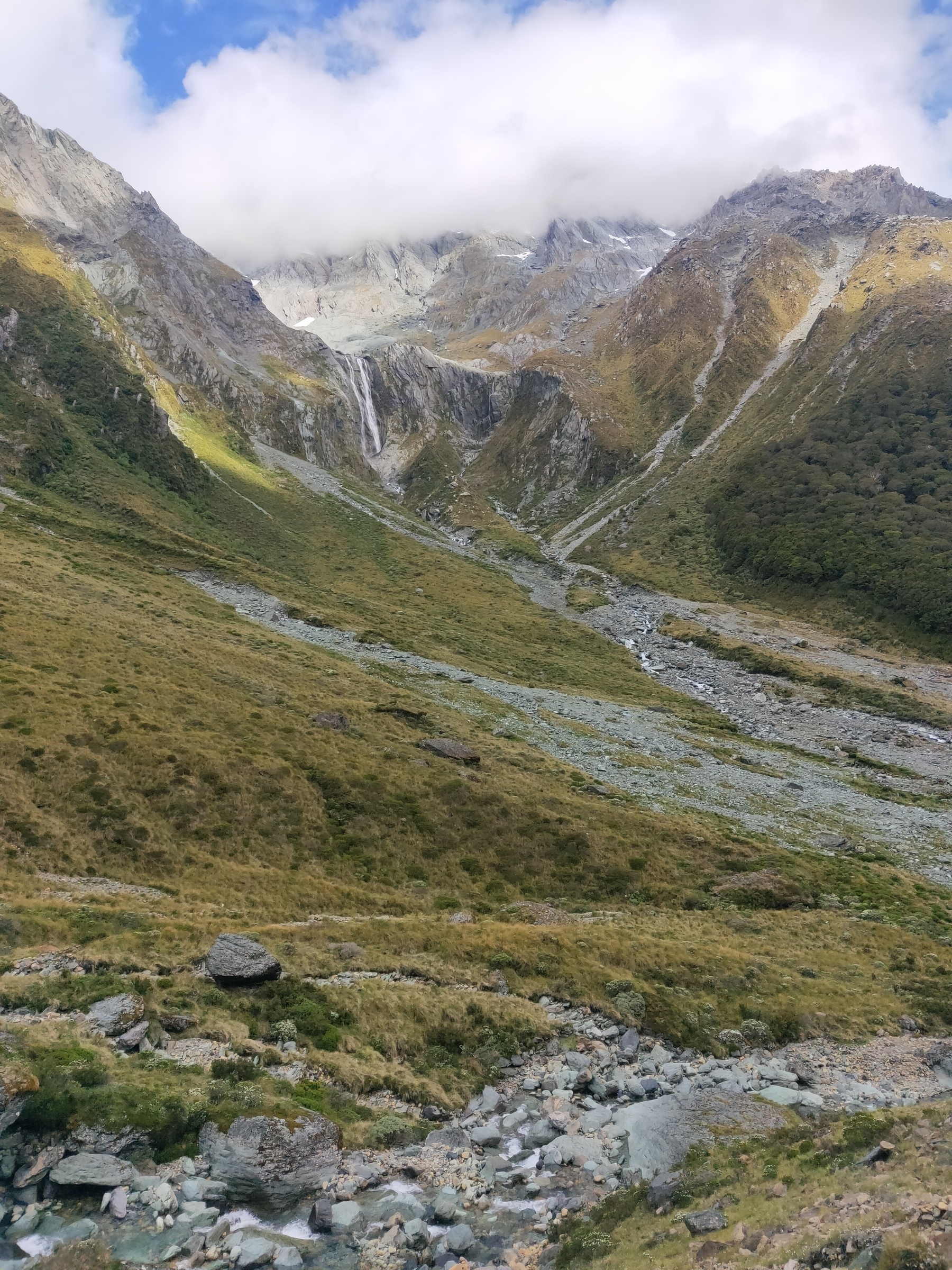
Fohn Lakes and the outlet
Looking SW along the Fohn Lakes outlet with Fiery Col out of shot to the left
Approaching Fiery Col (left saddle)
Passing a small waterfall approaching Fiery Col
Descending Fiery Col
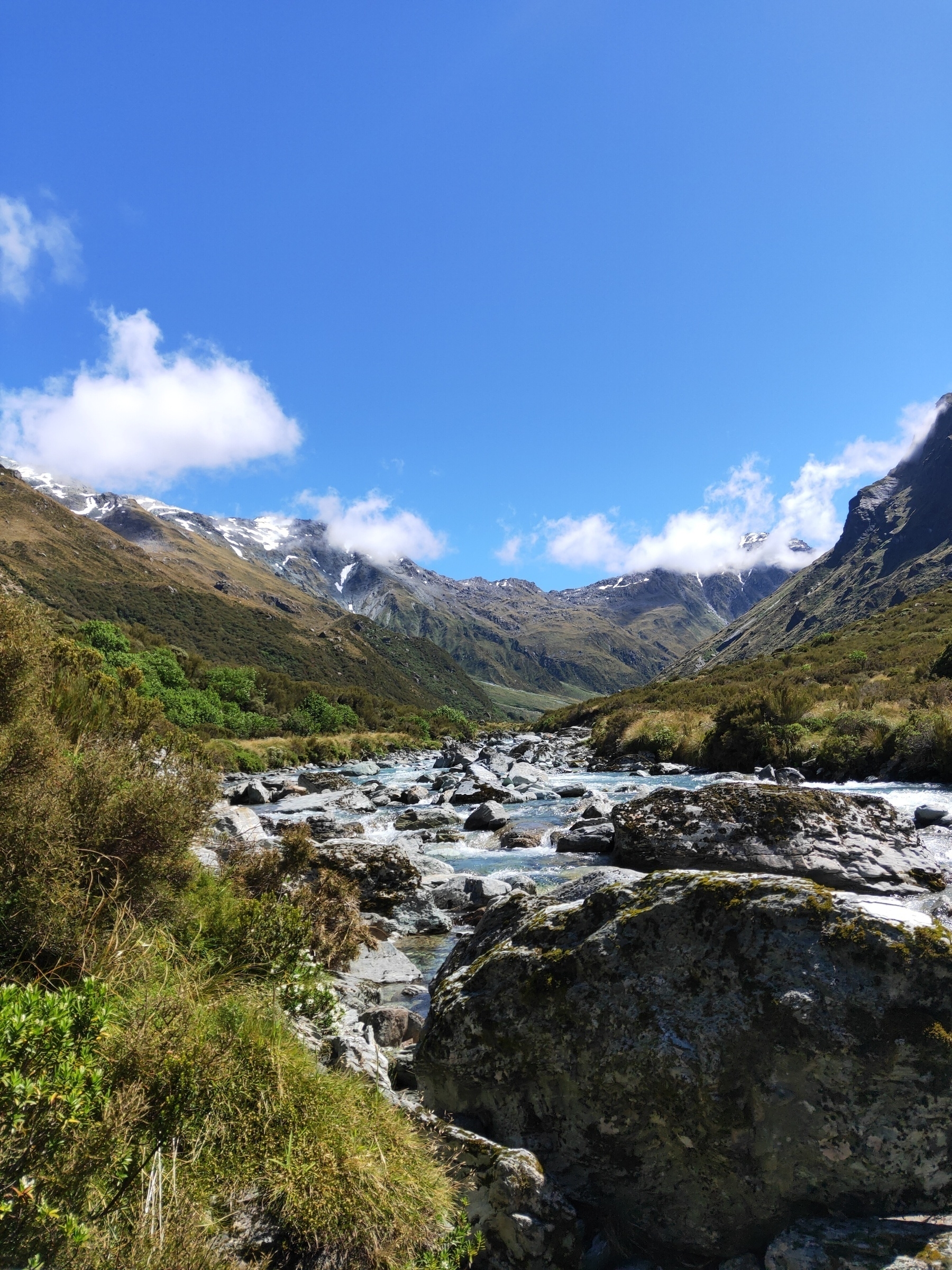
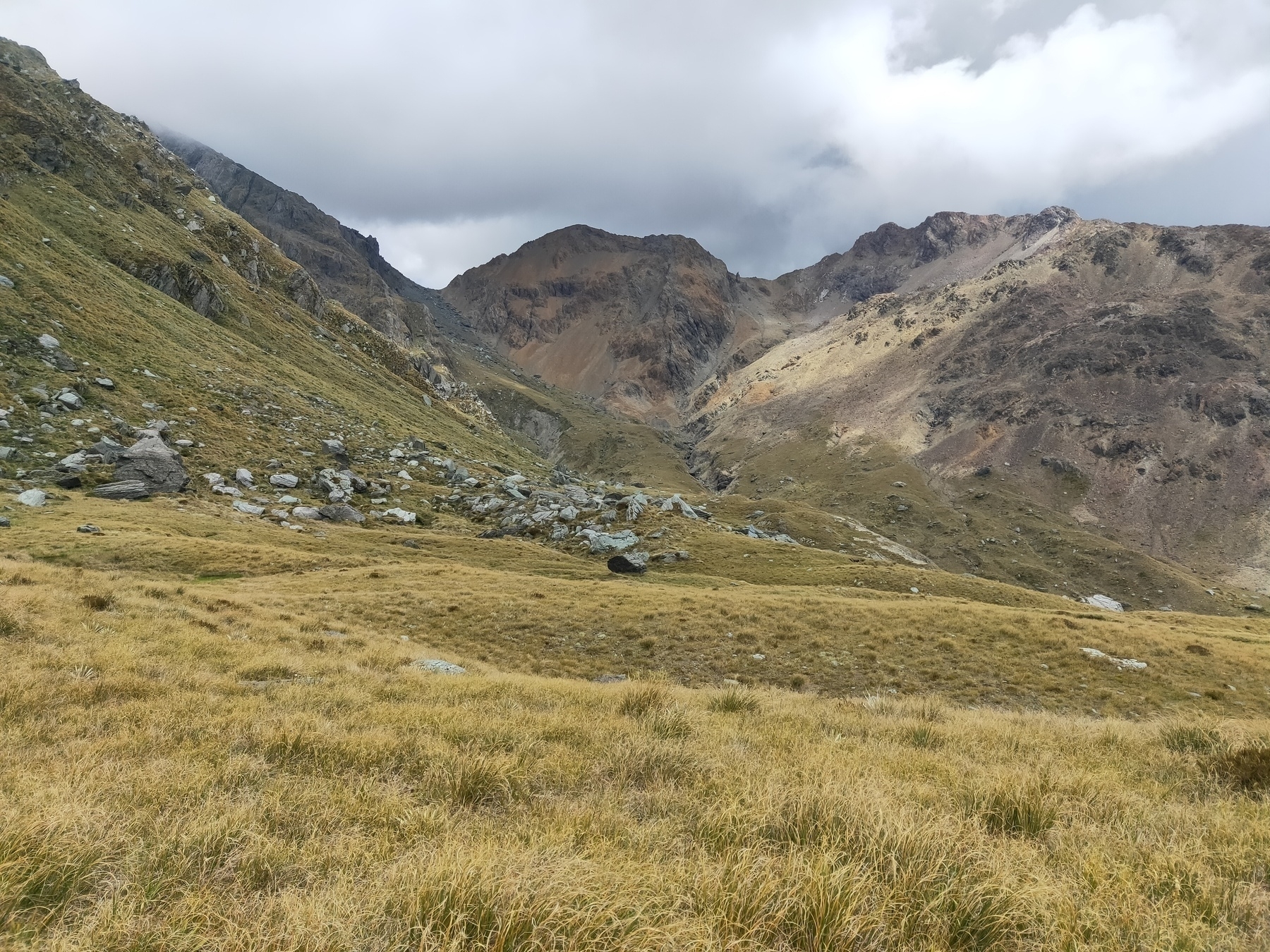
Approaching Cow Saddle
More mountain goodness
Looking down Hidden Falls Creek
Looking south over Park Pass, after an impressively steep climb
#trailrunning #bigslog
I think all the mountain slogging is catching up with me. Knees are not good. Time to take these strengthening exercises seriously. Physio tomorrow.
Wet morning.
#Queenstown
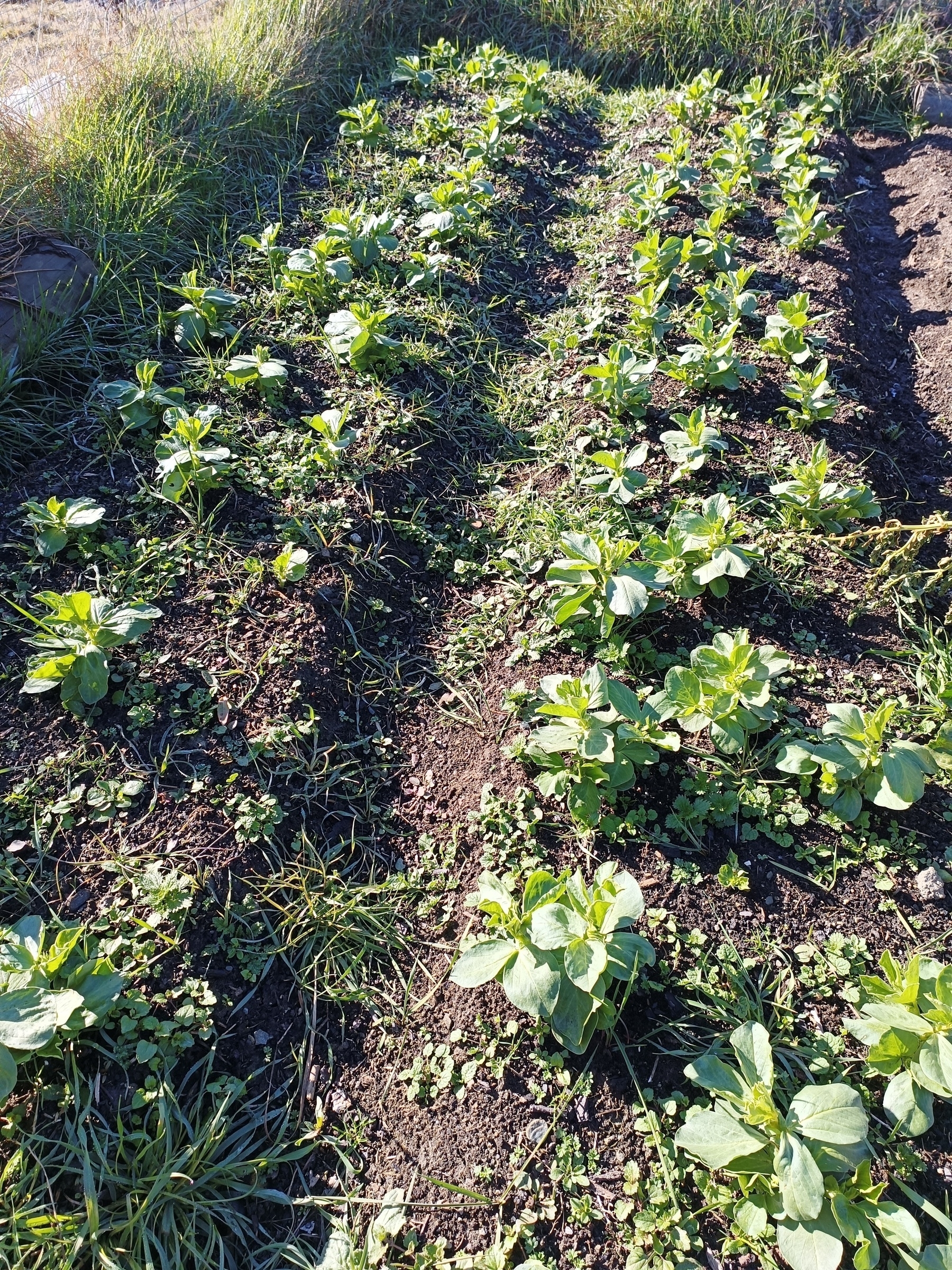
Made a climbing pole for the monstera and repotted it on an angle to make it easier to tie the main trunk to the pole and hopefully encourage upward growth. Not sure if this will be any better in the long run, but at least it’s not hooked to the curtains anymore.


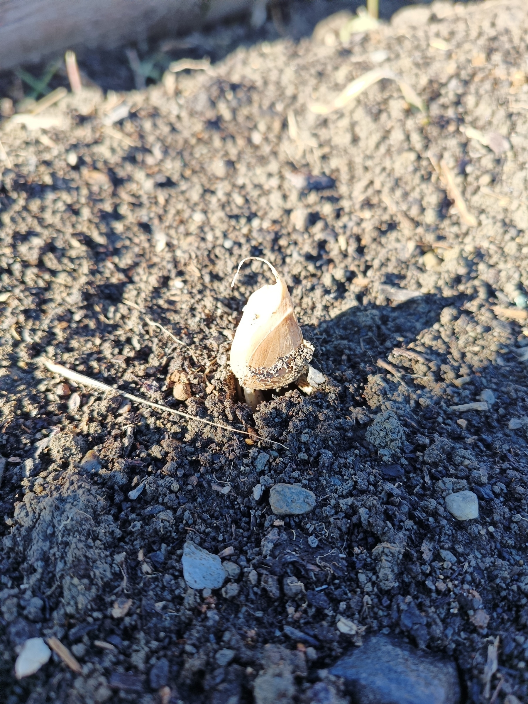
I may have planted the garlic too shallow. They’re just uprooting themselves. Will top up with soil and mulch.
Broad beans going ok. No idea if I was too early/late going into winter. Needs a weed.
#GardeningNZ #allotment #lunchwalk
Mt Aurum in a day
Date: 15 Jan, 2023 Location: Queenstown, New Zealand
Leg 1 (MTB)
Leg 2 (run)
Leg 3 (MTB)

Starting at Skippers Saddle the first MTB leg was down the flowy Long Gully track on my new dual suspension. What a way to break it in! This was a very fun descent into the valley. I eventually popped out onto Skippers Road which I rolled around til Skippers Cemetery where I dumped the bike and donned the joggers to start the foot leg to Aurum.
I trotted along Skippers Creek on Bullendale Track for a few kms before taking a left at the fork towards on Dynamo Track. Had a chat to a young family who had camped the night near Dynamo Hut. Things slowed down here as the track continues to incline and fades away past Archie Hut. From here I picked my way through tussock and continued the climb towards Aurum where it finally started to peek out from the clouds.
Skirting under the tormenting face I aimed for the saddle between pt1872 and Aurum before deciding my final line to the top. I opted to climb the ridge as best I could, which I managed, but it definitely tested my nerves. There was lots of loose rock and dirt so I had to shimmy my body weight carefully. It was steep too. The photos don’t do it justice. After soaking in the views at the top, regaining my nerves and having a snack I descended a slightly easier way, skipped over to Dandy’s Saddle and started the descent into the next valley over.
I took the wrong line, hitting what felt like a cliff, so had to backtrack up the hill and go again a spur over. From here it was trudging through the creek past Bullendale Hut then back onto Bullendale Track and back to the cemetery for my bike.
The ride out was bloody horrible. A big climb out of Skippers on a very tired body. I was completely shot. Slammed a cold drink back at the car and laid in a slump for a while before heading back home. That was a big day. 13 hours all up.


#trailrunning #MTB
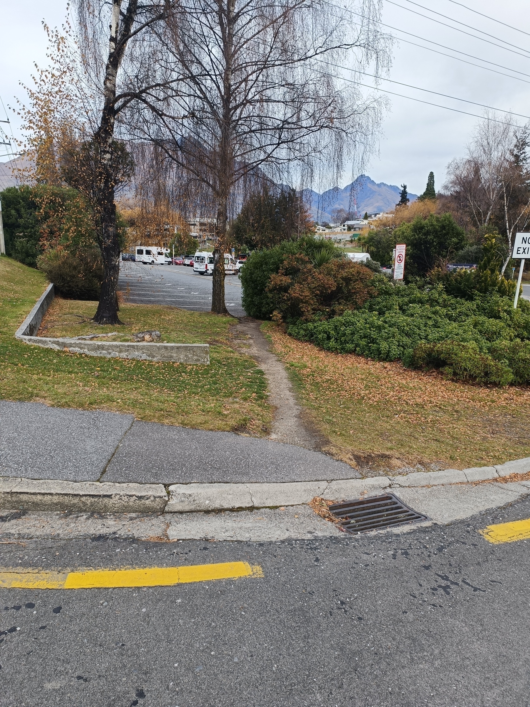
Desire line swinging under a birch tree into the public carpark. There’s a vehicle entrance to the right of the shrub for wet days. The carpark takes 33 campervans and it’s regularly full in peak periods. I occasionally trot this path on my lunch walks.
#DesireLine #DesirePath #Psychogeography
Great idea @birming@mastodon.world. I’m enjoying the material. Here’s my #Junited2024 contribution, with a focus on location and places. zakb.micro.blog/junited/
Gloves didn’t quite cut it at 0°C. Liners next time.
#rookie #winter #commuter

Weeknote 2024-22
Forward Focus
#weeknotes


